Imereti Region – East




Kharagauli Municipality
Nunisi – a health resort and balneological resort famous for its natural beauty,( knowns as “Samta Nunisi”), is located in the southeastern part of the Borjomi-Kharagauli National Park, at the foothills of the Likhi Range, at an altitude of 750 meters above sea level. The unique microclimate of Nunisi is created by mixed, deciduous and coniferous forests. The Nunisi River flows through the resort.
The resort has existed since 1856. Nunisi has been known since ancient times for its mineral (balneological) waters with healing properties. Resting here is especially beneficial for those who suffer from skin and nervous diseases. It is also possible to drink Zvare mineral water here. Zvare water is also medicinal and balances low acidity.
In spring, during the flowering of pine and spruce trees, the air of Nunisi has an amazing healing effect. At this time, the air of Nunisi is especially beneficial for the lungs and bronchi. You will also receive aesthetic therapy at the Nunisi resort. The amazing nature will calm you down and make you healthier.
Hotel Nunisi Resort is the place to stay at Nunisi. Here is their facebook page

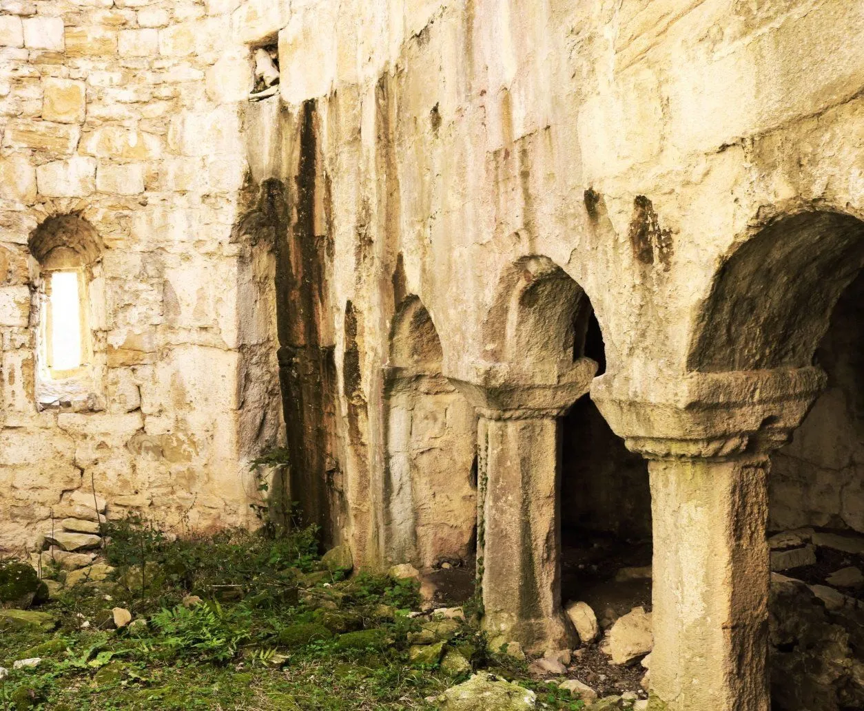
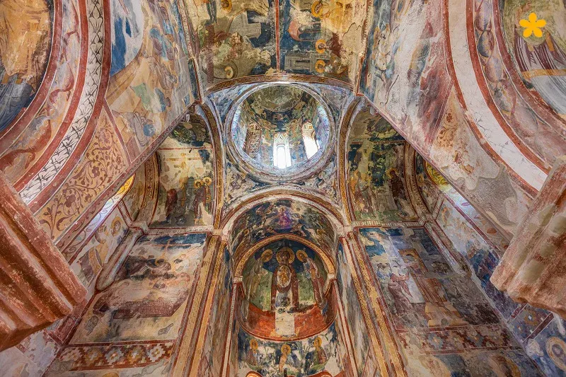
The Church of the Virgin Mary of Nunisi is located in the village of Nunisi, Kharagauli Municipality, in the Imereti region. It dates back to the 9th-10th centuries. The building has been destroyed and rebuilt many times. The last time the church was destroyed and burned was by Omar Khan in 1785, after the capture of the Vakhan fortress, and it was not rebuilt until the 19th century. The Church of the Virgin Mary of Nunisi is a three-nave basilica. The central nave is separated from the side naves by three arches each. The arches rest on massive columns. The church has two entrances, to the south and west, both of which are architraves, with open arches cut above the architraves. The building has arched windows, in which wooden frames and glass are currently inserted. The church is built of various sizes of rock and shale stone on a lime mortar. Currently, the interior of the church is completely plastered. In the courtyard, there is a stone fragment with a fragment of an Asomtavruli inscription. The temple is surrounded by a wall built of rock and cobblestones.
Berebis Klde
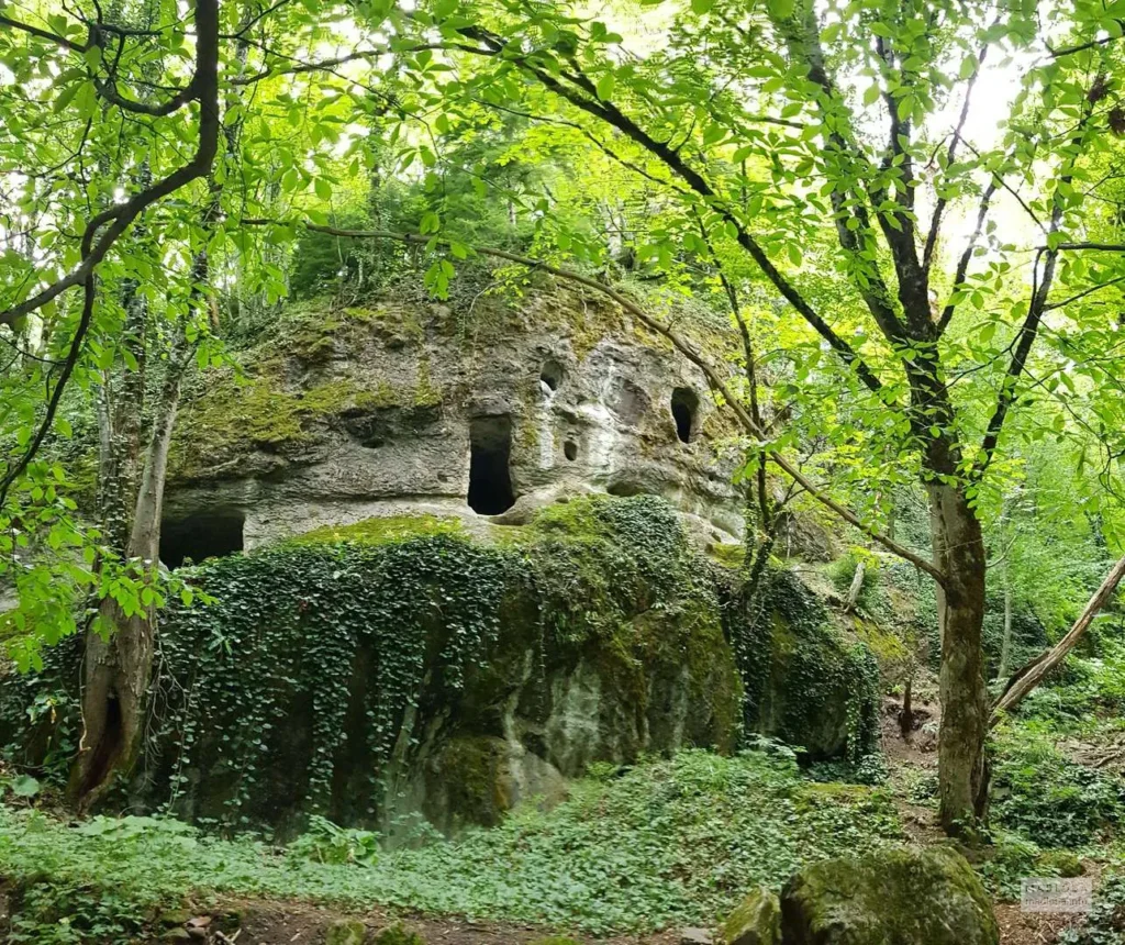
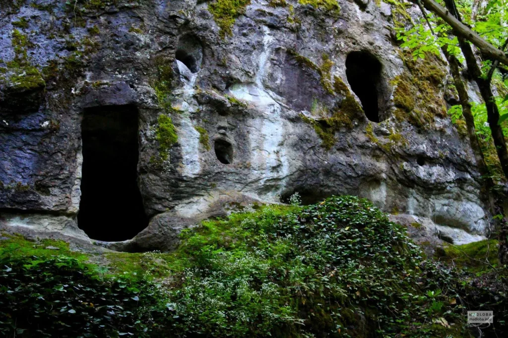
The Monks’ Rock is located in the village of Nunisi, Kharagauli Municipality, in the Borjomi-Kharagauli National Park in the Imereti region. It is a complex of caves carved into the rock of the developed Middle Ages. The caves are carved into the upper part of the bare plateau in two tiers. The chambers are connected to each other by exits and steps carved into the rock, and a narrow path is left in front of them. One of the chambers has an imprecisely shaped vault. There is also a water reservoir here, where water still collects today. There are notches and an arched niche carved into the walls of the chamber. At the bottom of the caves is a vaulted chamber, half cut into the ground, built of unprocessed stone and limestone, which has a rectangular entrance from the west. A few kilometers from the Monks’ Rock is the 9th-10th century Nunisi Church, which, according to legend, was connected to the caves by a secret tunnel.

The Vakhani Fortress is located in the village of Vakhani, Kharagauli Municipality, in the Imereti region. It dates back to the 10th-11th centuries. In the 16th-18th centuries, the Vakhani Fortress was one of the main border and land strategic points between the kingdoms of Kartli and Imereti. In the 18th century, the fortress was attacked by the Ottomans. In 1785, it was taken by Omar Khan, who arrived with an army of 20,000. On April 25, 1804, in the vicinity of the Vakhani Fortress, in “Elaznauri”, the Chief Governor of the Caucasus, Pavle Tsitsianov, and the last king of Imereti, Solomon II, signed a treaty known as the “Elaznauri Agreement”, according to which Imereti was declared a vassal of Russia. The Vakhan Castle functioned before Georgia’s annexation by Russia.
The Vakhani Fortress is built on a high hill, near the foothills of the mountain of the same name. Its power, scale, strategic soundness and high construction art attract attention. The Vakhani Fortress belongs to the best group of fortresses of the early period and is considered one of the most magnificent examples among them. It is built on a rocky promontory and is surrounded by a very high wall. Of the fortress buildings, the large, square-planned main tower, located to the south of the courtyard and built on the wall, is particularly impressive. The rectangular entrance to the tower is located in the upper part of the high floor, where it seems that they climbed up a ladder. The great skill of the fortress planners in military and construction work is evidenced by the high walls built with a close arrangement of roughly processed, smoothed-cornered large squares and the corners raised with relatively large stones.
Nearby, in the Village Vakhani you can see an over 150 year old water mill. It’s in a poor condition, but is still functioning and is used by locals.
View on map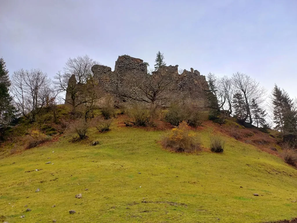
Motsameta Monastery
Is located in the Imereti region, in the Tkibuli municipality, near the village of Motsameta. It was built in the 11th century, although it acquired its current appearance in the 19th century. The history of the monastery’s founding is associated with the names of the Argveti princes – David and Konstantine Mkheidze. In the 8th century, during the invasion of Murvan the Deaf, they put up great resistance to the Arab commander, and were eventually martyred. The Georgian Church canonized them as saints. The relics of the saints who were martyred for their homeland and faith were originally buried in the ruined Church of the Annunciation. Bagrat IV built a small domeless church on the site of the church destroyed by the Arabs and transferred the remains of the saints to a new church. The name Motsameta is also connected with this history.
The Church of the Martyrs is a cross-domed building. All four arms of the cross are equal. The dome rests on four columns, two of which are the altar pillars. The peculiarity of the temple is the altar arranged to the north. This may be due to the fact that the relics of the saints were buried in the east – in a place of honor, so the architect moved the altar to the north. There are two entrances – to the west and south. The altar is separated by a 19th-century wooden pediment, on which stories from the Gospels and the lives of the saints are presented. On its left side, on an elevated place, on two carved wooden lions, lies a wooden ossuary in which the relics of the saints are placed. Painting has been preserved in the nave of the altar – a composition of prayers, which seems to have been done in the late Middle Ages. To the south of the church stands a two-story bell tower from the 19th century. The remains of two towers have been preserved on the territory of the monastery. The monastery complex is surrounded by a wall fence.
The Ubisa Monastery
Was built in the 9th century by Grigol Khandzteli with the help of the Abkhazian king Demeter and with the cooperation of his disciples, Christopher and Theodore. Giorgi Merchule describes in “The Life of Grigol Khandzteli” – “Then the father Grigol built a monastery according to the faith of the king and called its name Ube and appointed Hilarion, a certain faithful old man from Jerusalem, as the abbot”.
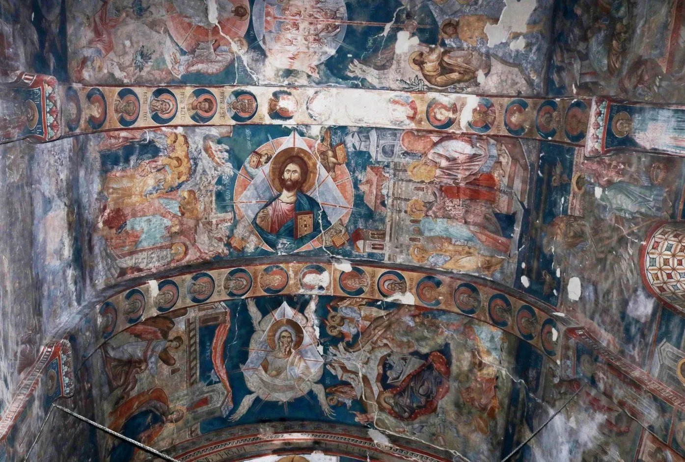
In the 14th century, during the reign of King Giorgi Brtskhinvali, the Ubisi Temple was painted. The temple presents a magnificent composition of all the Lord’s holidays: the Annunciation, the Assumption, the Crucifixion, the Resurrection, the Epiphany and others. Among the frescoes, the “Ubisi Fresco of St. George” and “The Last Supper” stand out.
The main temple is of the hall type. Its main core is the main building erected in the center of the wall, which has outbuildings from the south, west and north.
The monastery building also includes a tower, which was built in 1141 by Svimon Chkondideli during the reign of Demeter. The tower is a four-story building, each floor has one room.
View on map




The Church of St. George of Savani (Boriti)
In Boriti is a monument of Georgian architecture in Georgia, in the Kharagauli municipality of the Imereti region, southeast of the village of Boriti, on the left bank of the Dziruli River, in a cemetery. It dates back to the 10th century, with later additions on all three sides.
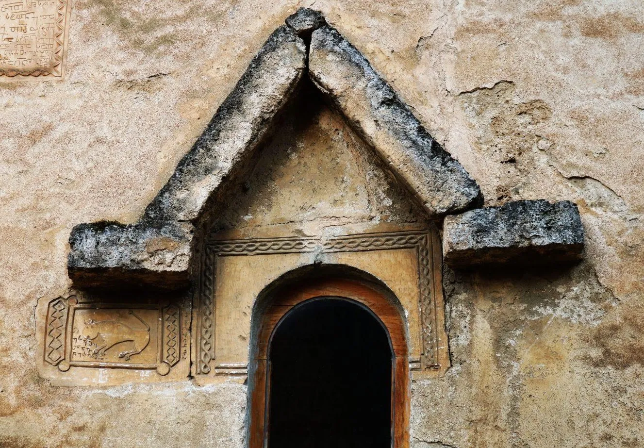
The church is mainly built of well-worked stone squares on a lime kiln; unprocessed stones were used in the lower part of the western facade. The church shows signs of reconstruction. In plan, the church is rectangular, with a semicircular apse to the east, under the window of which is an arched niche, in front of which stands an altar stone. There are also two niches to the north and one to the south. The floor is paved with stone tiles, the vault is cast in plaster. The interior is completely painted, the painting was restored about three years ago. The entrance from the outside, south and west is arched, and from the inside it is arched. A cornice runs along the entire length of the south wall, below which, to the left of the entrance, traces of painting have been preserved, and minor restoration work was also carried out in the upper part of the south facade in the 1980s. A statue of a sheep is included in the arrangement in the upper corner of the pediment of the west facade. The hall was lit by windows on the south, west and east. The west and south windows are narrowly arched, while the east one, which is carved in a single stone, is oval in shape
View on mapKozmani Church
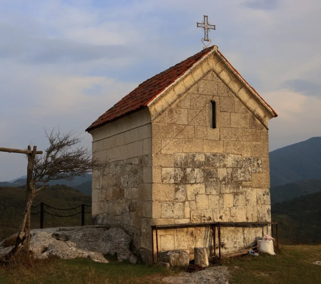
Is a monument of Georgian architecture. It is located in the Dzirula River gorge, on the left bank, 6 km from the central highway (Boriti), in the eastern part of Kozmani Mountain. It dates back to the 8th century.
The church is built of grayish stone squares of various sizes on a lime mortar. The arrangement is chaotic. The church is rectangular in plan, with a beautifully outlined semicircular apse to the east, the sides of the apse protruding from the longitudinal walls by a few centimeters. There are two small rectangular niches in the apse, one to the south, the other to the north. Today, the church has no windows. The entrance is from the south, it is architrave. In the lower part of the entrance, on the left side, there is a several-line Asomtavruli inscription on the stone. The lower part of the inscription is covered by the fourth step of the four-step staircase arranged for the entrance. The church has no vault or dome. It is roofed with corrugated colored tin.
100-150 meters from the church is the Kozmani Fortress.

Kozmani Fortress
Is a fortification in Georgia, in the Kharagauli Municipality of the Imereti Region, southeast of the village of Amashuketi, on Mount Kozmani. The eastern part of the mountain is a rock, and from the west it is a completely flat field , from which the mountain can be reached.
In the southeastern part of the mountain, the ruins of the fortress wall have survived on the edge of the rock. The fortress was built mainly of small-sized quarried stone on a lime kiln. Quite large stone squares were also used, which have survived in the southwestern part of the fortress. On this side, outside the fence, a pit cut into the rock has survived, in which a qvevri was placed, which is now broken. The remains of several buildings can be seen in the inner territory of the fortress, one of which must have been a water reservoir.

Chkheri Fortress, Zarni Fortress, Meliskari
A medieval fortress in western Georgia, Imereti, on the territory of the village of Chkheri, now Kharagauli Municipality. The fortress is located on a high, rocky mountain. It was first mentioned in sources in the 17th century. It was built in the 15th-17th centuries.
The fortress has survived in a semi-ruined form, consisting of upper and lower fortresses. The upper fortress contains various storage rooms, pitchers and a water basin. In 1774, Solomon I and Erekle II brutally defeated the Ottomans at the “Battle of Chkheri” near Chkheri. The main battle of Imereti against Russia in 1810 also took place near Chkheri Fortress, in which King Solomon II was defeated.
On January 18, 2018, the fortress was granted the status of an immovable monument of cultural heritage.
View on map
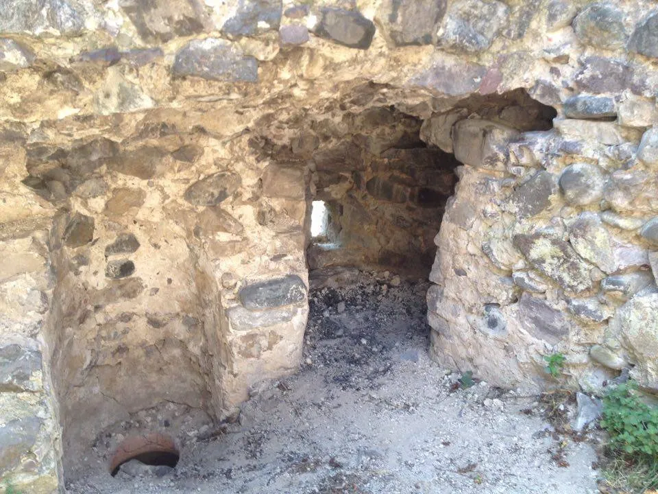
Nakodi Waterfall
Is located in the village of Marelisi, Kharagauli Municipality, Imereti Region, within the Borjomi-Kharagauli National Park. The lush green valley and beautiful waterfall are perfect for short hikes in nature. The sounds of nature, cool water, fresh air, and tranquility create a wonderful environment. If you want to relax in the wild, Nakodi Waterfall is one of the best places to do so.

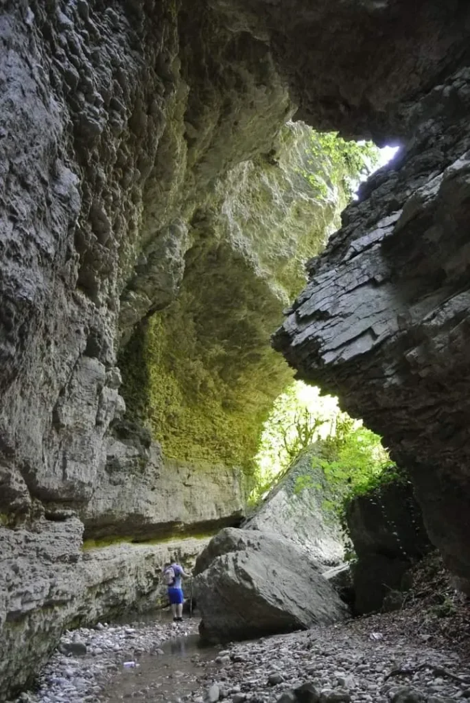
Tsashekrula Canyon
Is located in the Imereti region, in the Kharagauli municipality, on the territory of the Kharagauli settlement, at an altitude of 300-350 meters above sea level. It is a canyon-like valley. Huge rocks, which in some places almost form a tunnel-like passage, create a beautiful sight. It is because of the rocks that are glued together that this valley was named Tsashekrula, because in such places the sky is not visible. Tsashekrula Canyon is one of the great places for short hikes, wandering in the tranquility of nature and relaxing.
Nebodziri Tower — an architectural monument in the village of Nebodziri, Kharagauli Municipality. It dates back to the 17th-18th centuries.
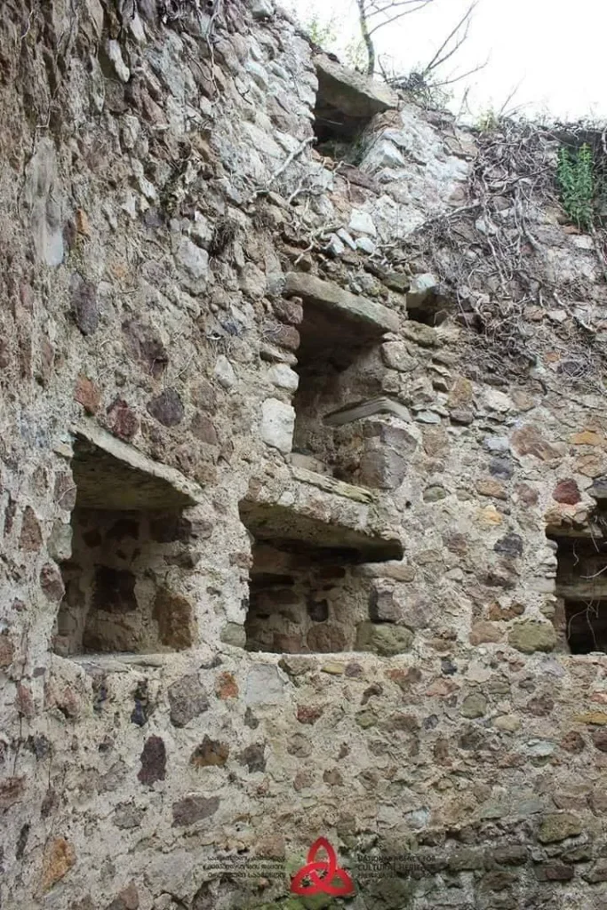
The tower is four-story. It is built of cobblestone and rubble stone on a foundation, with bricks used to support the arches. It is cylindrical in shape, narrowing slightly upwards. The entrance door is on the third floor level. The door is made of natural stone and is arched. On both sides of the inside, there are door-locking holes cut out. The first floor is windowless. On the second floor, there is a two-windowed turret, around which four rectangular niches are made at floor level. On the eastern side of the third floor there is an arched fireplace.
View on map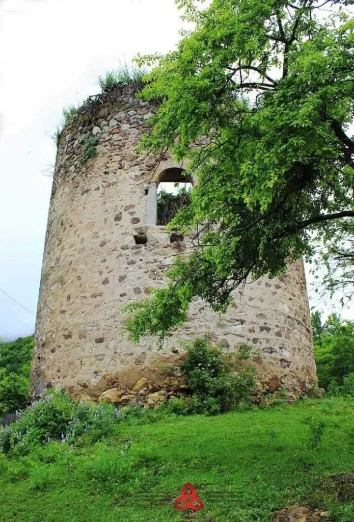
Sachkhere Municipality
Sachkhere is a city of Western Georgia, Imereti region, the administrative center of Sachkhere Municipality. It is located on the banks of the river Kvirila, 500-550 meters above sea level. It was declared a city in 1964. Roads of state importance are connected to Zestafoni and Gomi village and Zestafoni with the railway line.
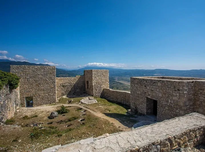
Modinakhe – Modimnakhe Fortress
A late medieval fortress in the Imereti region, one kilometer north of Sachkhere, 700 meters above sea level. Built in the 1830s by Papuna Tsereteli.
Modinakhe is also a famous archaeological site. Settlements from 3 eras have been discovered here: settlements of the Early Bronze Age, Late Bronze – Early Iron Age, and Early Antique. Burials from different periods have also been excavated. A variety of pottery, bronze weapons, and jewelry have been found at the settlement and in the tombs. Many gold and silver items (jewelry, utensils, weapons), Colchian and Roman coins have been found in the tombs of the Early Antique-Hellenistic period. Modinakhe Fortress was designated a national monument on May 11, 2018.The architectural complex of the “Modi-Nakhe” Fortress was renovated in 2019. The fortress stood on a high limestone ridge, with a road leading up the slope from two sides. The fortress had two long walls, one of which was closed by a high tower, and two towers stood at the end of the other wall. In the middle of the space stood a house, a chapel, and a prison. Qvevri was buried in the courtyard.
According to legend, the future father in law = Davit Abashidze. refused to marry his daughter to Papuna Tsereteli, and the reason was that he did not have a fortress. After that, Papuna Tsereteli built a fortress and ordered David to “Come and See”. ( Georgian: modi-nakhe.)
In the 1830s, the castle was half-ruined. Two old culverts stood on the castle. Part of the walls and seven towers survived. The castle was so damaged by the 1991 earthquake that today all traces of its towers have disappeared, and the walls are badly damaged. Despite its dire condition, the castle makes a great impression on the visitor. The castle offers a beautiful view of the Kvirili River gorge, as well as the mountains of Imereti and Racha.


The Jruchi Monastery
Is located in the Imereti region, in the Sachkhere municipality, near the village of Tskhomareti. It was founded in the 11th century. In the following period, the monastery was destroyed, and in the 16th-17th centuries it was rebuilt again. At the end of the 17th century, the Jruchi Valley was controlled by the Racha eristavi and the Tsereteli noble family, which is why the monastery complex already served the purpose of a fortress. In the 1860s, Solomon I restored the Jruchi Monastery and granted it independence.
The Jruchi Monastery includes the remains of an 11th-century domed church and other medieval buildings. After the 1991 earthquake, only two walls and the walls of the gate leading to the monastery courtyard survived. The courtyard is scattered with temple carvings and parts of columns. The church of Jrucha was a domed basilica. The church was originally supposed to be a domeless building, but it was later converted into a dome. The interior was plastered with lime. The church is built of cut stone. The building was decorated with remarkable reliefs. Of particular interest is the bas-relief of St. George, which depicts two Saint Georges, facing each other. One of them is fighting a dragon, and the other is fighting the Byzantine emperor Diocletian. This bas-relief is unique in its content and has no analogues in the world. The monastery of Jrucha is one of the most magnificent examples and occupies an important place in Georgian architecture.

Akaki Tsereteli Cave
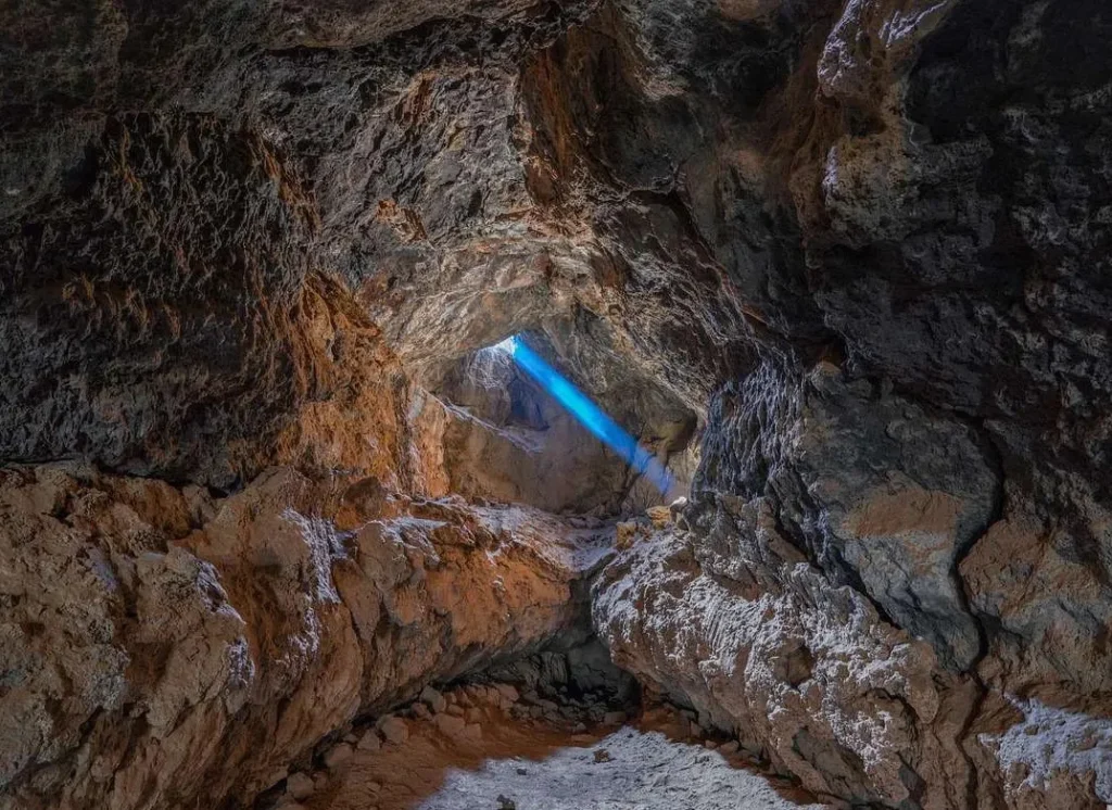
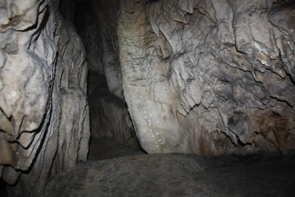
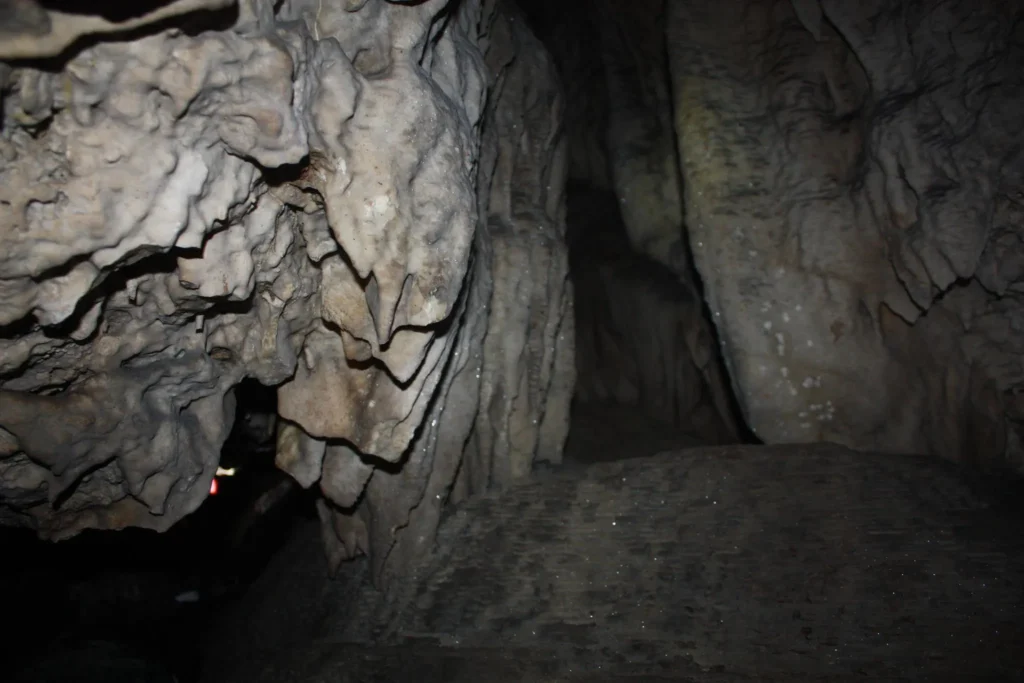
Is located in the Imereti region, in the village of Sareki, Sachkhere municipality, at an altitude of 455 meters above sea level. It is a karst cave carved into Upper Cretaceous limestone. The entrance to the cave is a rocky ledge, which consists of a descending bottom and karst tunnels. The depth of the cave is 12 meters, and the total length is 45 meters. The Akaki Tsereteli Cave contains very beautiful sedimentary formations: stalactites, stalagmites, calcite formations. A small stream flows through the cave. The cave is a four-story cavity and speleological equipment is required to reach its end. Akaki Tsereteli Cave is one of the attractive attractions of Sachkhere.
The Church of St. George of Chala, also known as the Abashidze Church, is an immovable cultural monument of national significance in the village of Chala, Sachkhere Municipality, Imereti Region. The Church of St. George of Chala dates back to 1510. The single-nave basilica is located on the right bank of the Kvirila River. The small medieval church was the property of the Abashidze family. The temple is covered with frescoes. The church is surrounded by an evergreen forest. The temple is still in use today
View on map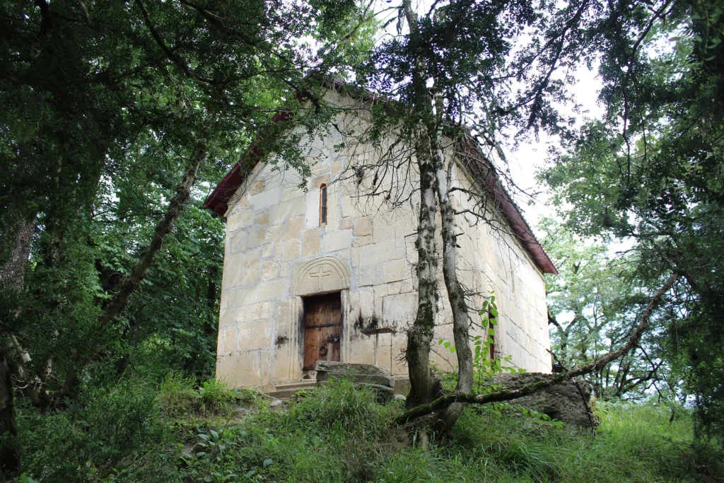


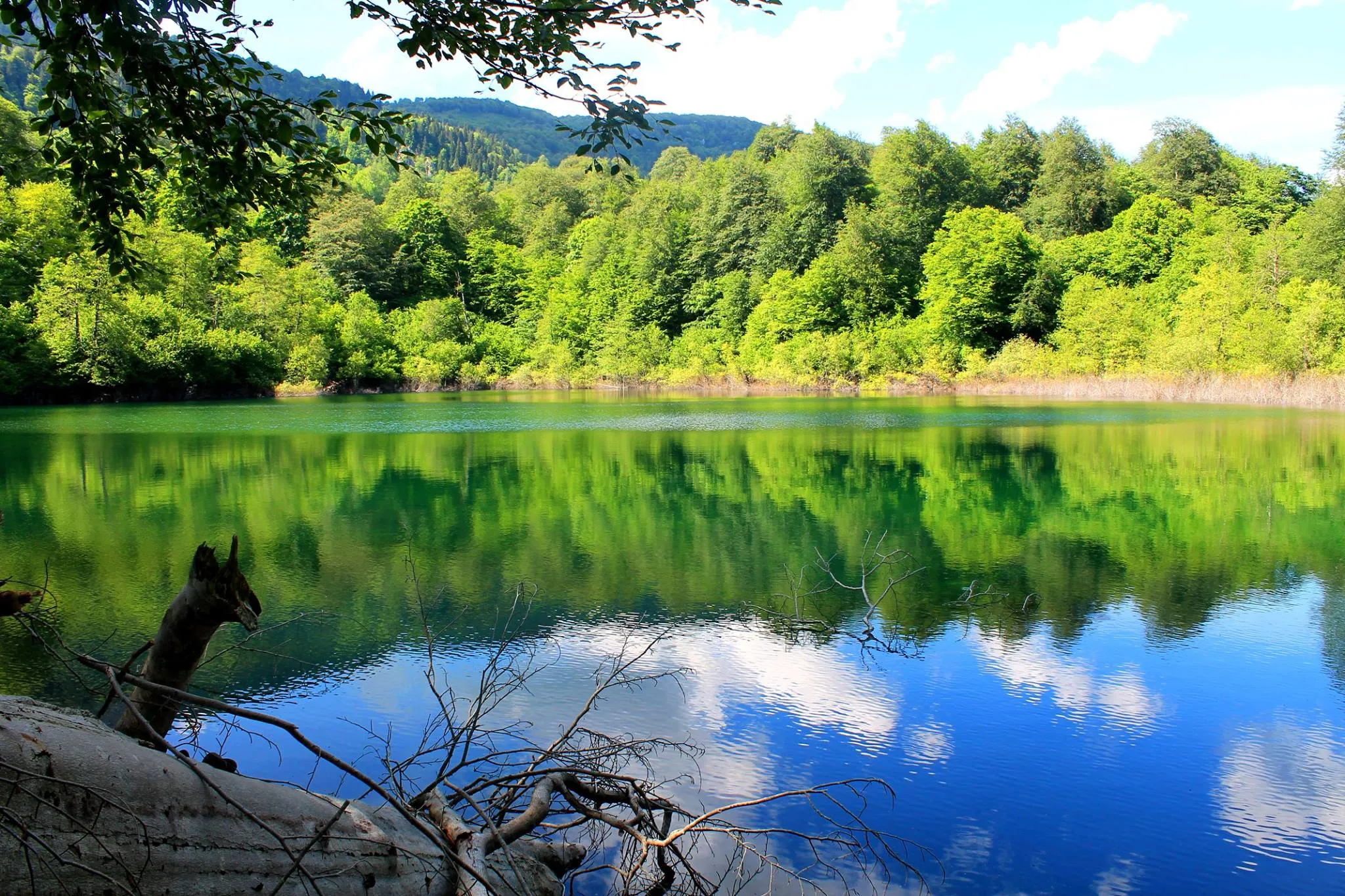
Devi Lake is located in the Imereti region, in the Sachkhere municipality, at the foot of the southern slope of the Racha Range, at an altitude of 1,370 meters above sea level. It is a karst lake and contains two karst funnels. The surface area of the lake is 0.018 km², and the greatest depth is 10.7 m. Devi Lake is surrounded by forests and is a very beautiful sight, both in the greenery of summer and in the colors of autumn. The flowing water, wildlife, clean air and beautiful forests create a wonderful environment for nature lovers. The hiking trail to the lake is 4 km long and starts in the village of Mokhvi, the route is easy. Camping is also possible near the lake. The best time to hike to Devi Lake is from May to November.
View on mapThe Church of the Virgin Mary of Chikha (St. Barbara)
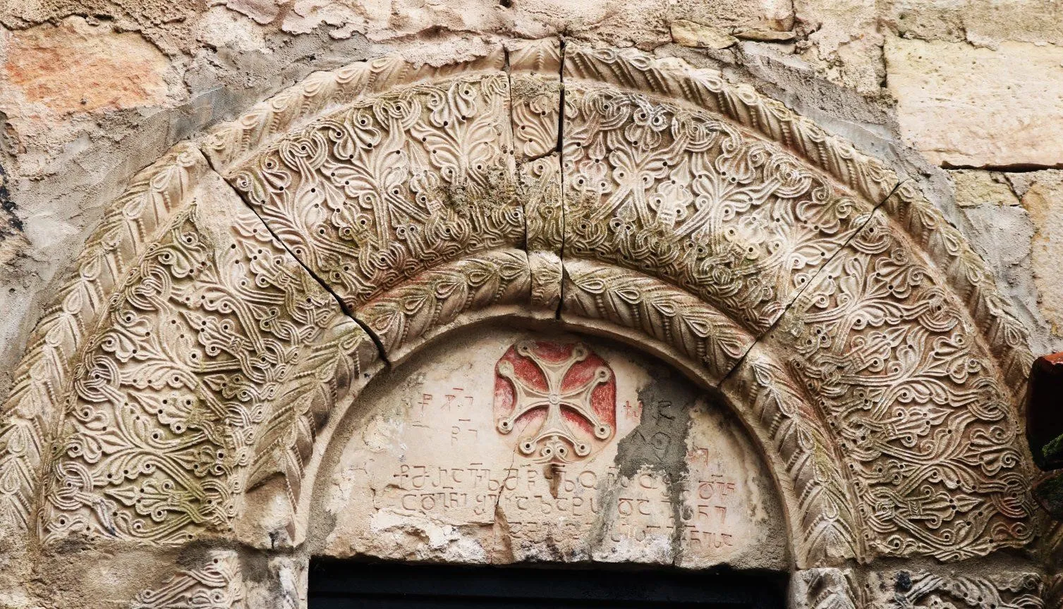
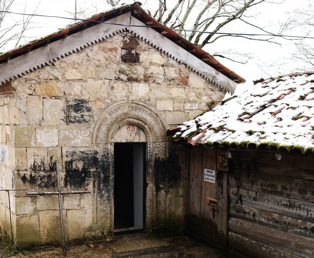
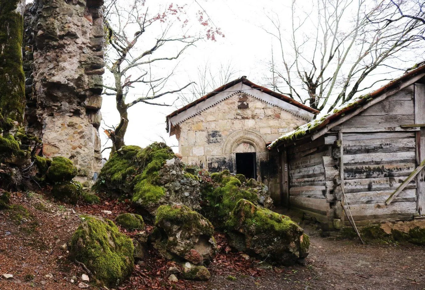
is an immovable cultural monument of national significance in the Imereti region, in the village of Chikha, Sachkhere municipality. The church is a single-nave basilica and stands on a small hill surrounded by forest, next to the ruins of a quadrangular tower. It is built of whitewash. The western door and cornices are (partially) decorated with precious carvings. Above the western door of the church, a stone cross decorated with a precious carved cross and faces is surrounded by a circular Asomtavruli inscription and at the base. Judging by its paleographic character and the art of depicting the cross, the inscription dates back to the 10th century. The church has preserved the remains of a blessing written in Nuskuri (georgian script)

Koreti Trinity Church
Is an immovable cultural monument of national significance in the Imereti region, in the village of Koreti, Sachkhere municipality.
The Koreti Savior Church is a single-nave basilica. The church has a gate to the south, a sacristy to the east, and a room to the west. A sacristy is built to the west of the basilica. It is built of hewn stone and lime, and is roofed with tiles.
The Koreti Savior Church is painted and is well preserved in the upper part of the altar and the middle church, but is damaged in other places. In the nave of the altar is depicted the Savior sitting on a richly decorated throne, blessing with his right hand, and holding an open book on his knee with his left. To the right of the Savior is depicted the Virgin Mary standing with an angel, and to the left is the Baptist also with an angel.
View on map
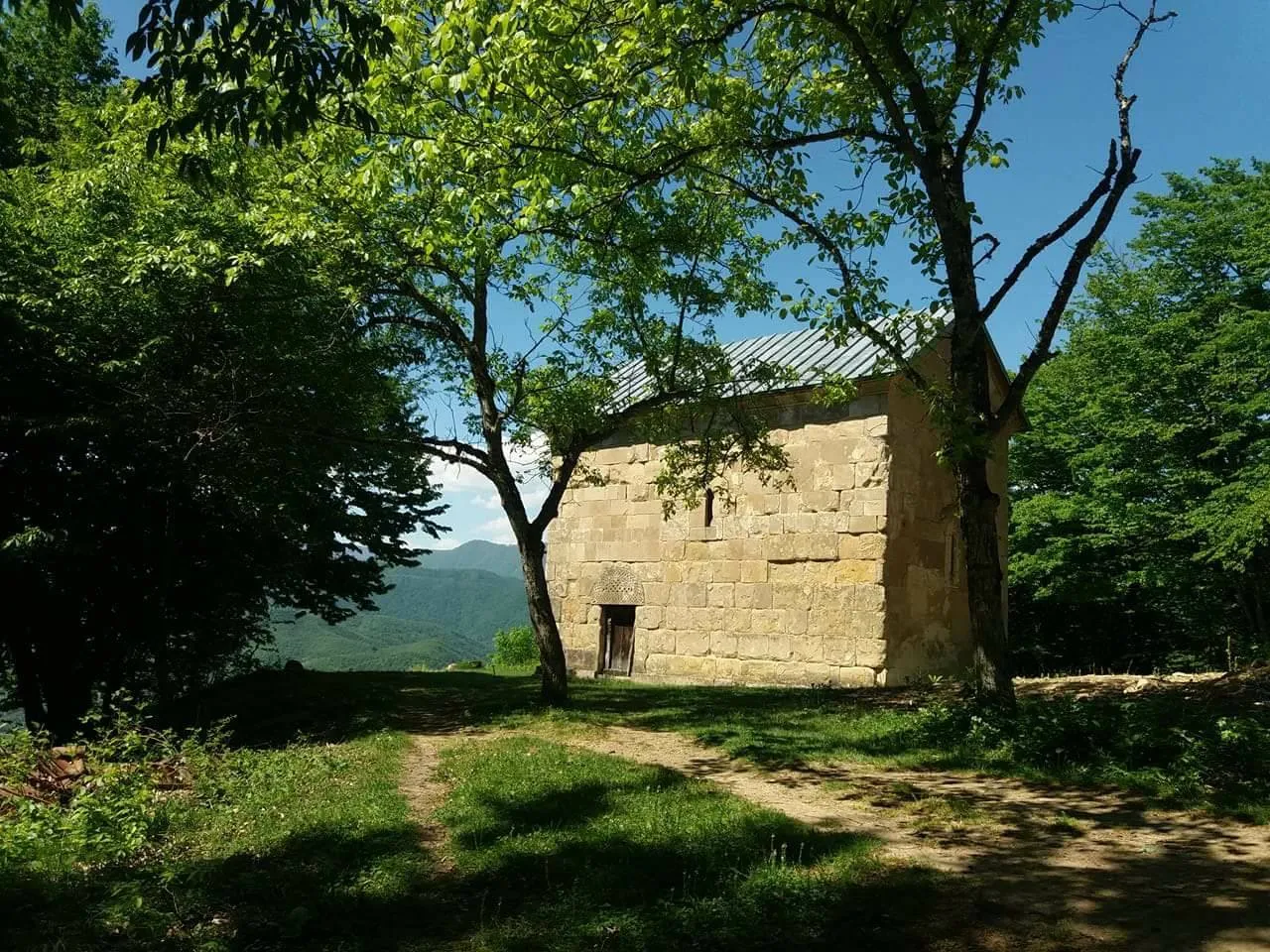
Holy Savior chapel of Speti
A church of the 10th-11th centuries in the village of Speti, Sachkhere Municipality, in the Kvirila River Gorge, away from the population.
The name “Zeda Matskhovari” has been established since the 19th century, after the second church of the Savior was built in Speti, which was located directly in the village and stood below the old church. Currently, there are two churches in Speti, “Zeda Matskhovari” and “Kveda Matskhovari.” The second church was partially destroyed by the 1991 earthquake and was rebuilt by the village population. As for “Zeda Matskhovari”, the identity of its architect has not reached us. It is known that the church was built at the turn of the 10th-11th centuries and is a single-nave hall-type building. Its architectural appearance has not changed over the centuries.
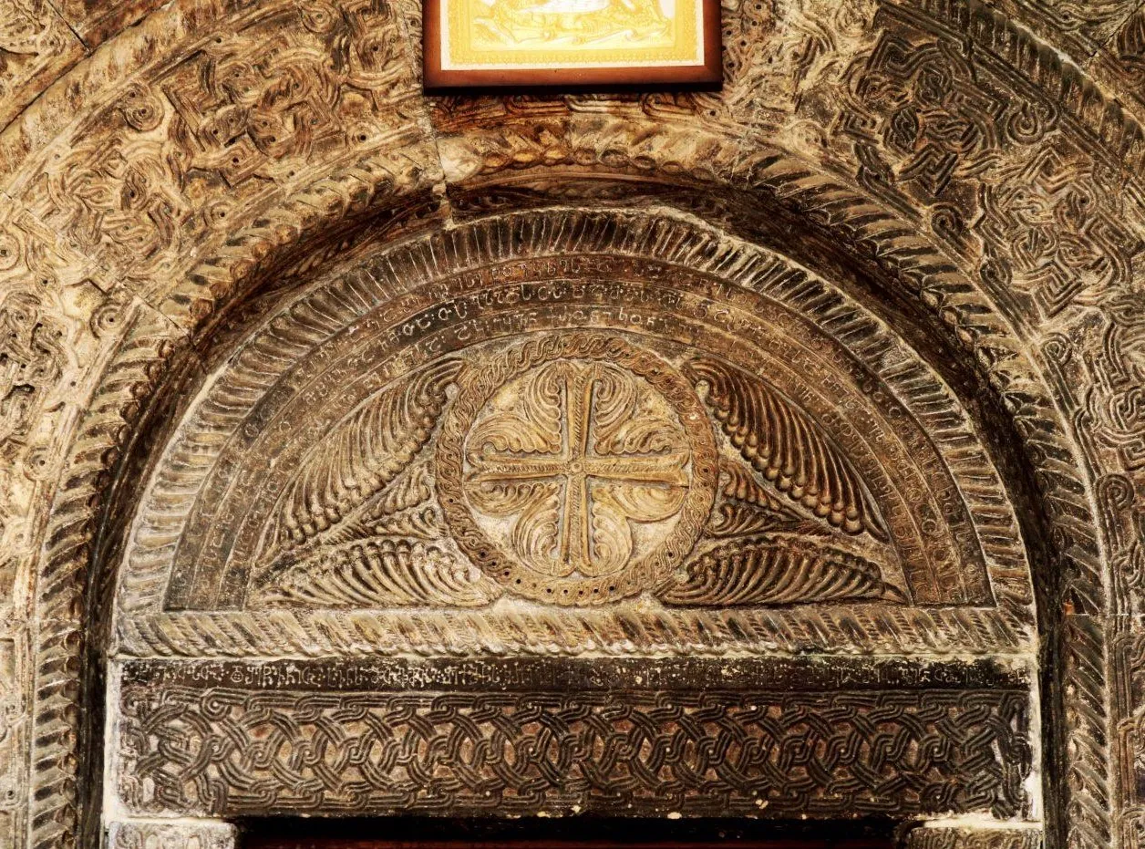
There are two Asomtavruli inscriptions on the eastern wall of the church, which are fragmentary and may be completely destroyed in the near future. The facade, the stone roofing, is in a serious condition, the stone has begun to disintegrate due to dampness and requires urgent restoration.
View on mapChurch of St. George of Savani
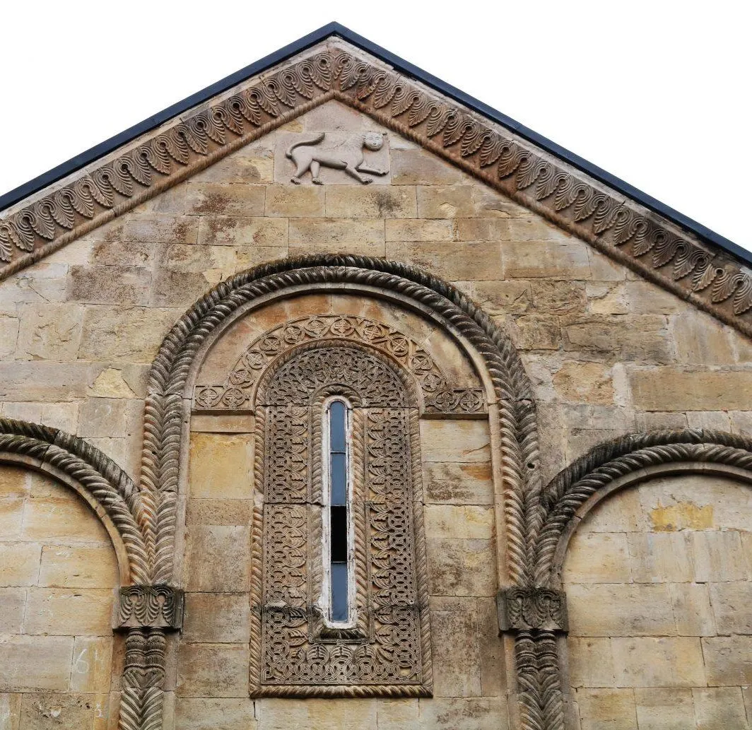
A single-nave church in the village of Savani, Sachkhere Municipality, Imereti Region. The inscription at the southern entrance indicates the exact date of construction of the monument − 1046, mentions the local feudal lord − Eristavteristavi Giorgi Son of Gulzviad, while the inscription at the western entrance states that the church was built by the architect Haraba. The building, which is simple in plan, is flanked along its entire length by a stoa − a doorway, which must have been built by another master a little later. The proportions of the church are harmonious and refined. The abundant and motif-rich decoration is organically combined with the architectural forms of the building. The church has a richly carved plaster spire of the 11th century, which was severely distorted during the restoration of the monument in the 19th century. The bell tower dates back to the second half of the 19th century.
View on map



Kvereti
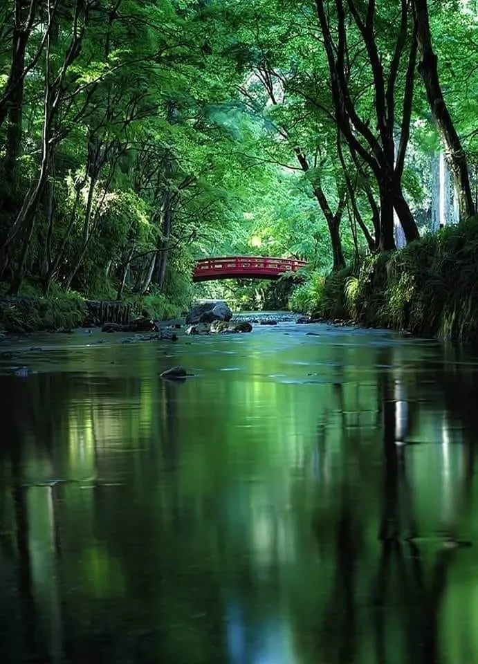
A low-mountain balneo-climatic resort of local importance in Sachkhere municipality. 570 m above sea level. It has mild winters (average January temperature 2.0—3.0°C), warm, moderately humid summers (average July temperature 20.0°C). Precipitation 1100-1200 mm per year. The main healing factor is low-mineralized water, which is used for baths. Water temperature 16°C. Day and night flow — 40 thousand. L. In Kvereti, they treat diseases of the joints, peripheral nervous system and gynecological diseases. There is a bathhouse, a rest house. Season — all year round.
View on mapChiatura Municipality
Chiatura Municipality is located in the Imereti region, Georgia. The area has been inhabited since ancient times, since the Stone Age. Remains of the world’s oldest thread have been found in the Dzudzuana Cave in Chiatura. The entire skeleton of a Paleolithic human was discovered for the first time in the history of Caucasian archaeology in the Kotia Cave on the territory of the municipality. Chiatura was inhabited during the Bronze Age and in antiquity. It was also developed in the Middle Ages, as evidenced by the many castles preserved and temples of high artistic value. Today, Chiatura is a developed municipality, in the formation of which the industry formed at the base of the manganese ore deposit in the Kvirila River valley played an important role. The district has a museum of local lore, a drama theater, sport and art schools, and other cultural and educational institutions. The area has small lakes and waterfalls that are perfect for picnics, small trips, although it draws special attention with its caves. The beautiful caves with amazing dripping forms make a great impression on the visitor. There is a famous natural monument in Chiatura – Katskhi Pillar, which is also a cultural monument. The municipality is rich in cultural and historical sights.

Chiatura
Is a city in the Imereti region of Western Georgia. In 1989, it had a population of about 30,000. The city is known for its system of cable cars connecting the city’s center to the mining settlements on the surrounding hills. The city is located inland, in a mountain valley on the banks of the Kvirila River.
In 1879 the Georgian poet Akaki Tsereteli explored the area in search of manganese and iron ores, discovering deposits in the area. After other intense explorations it was discovered that there are several layers of commercially exploitable manganese oxide, peroxide and carbonate with thickness varying between 0.2 m and 16 m. The state set up the JSC Chiaturmanganese company to manage and exploit the huge deposit.
Due to the steep sided river valley, production workers spent a large amount of time walking up from the town to the mines, thereby reducing productivity. In 1954 an extensive cable car system was installed to transport workers around the valley and up to the mines. The system’s 17 lines continued to serve the city using original hardware until 2021
In 2017, the Georgian government began rebuilding the system using modern cable car technology, beginning with the central four-line hub station. The revamped system opened in September 2021. The original Soviet-era system was deemed unsafe and taken out of service. The government plans to preserve its stations as heritage sites.
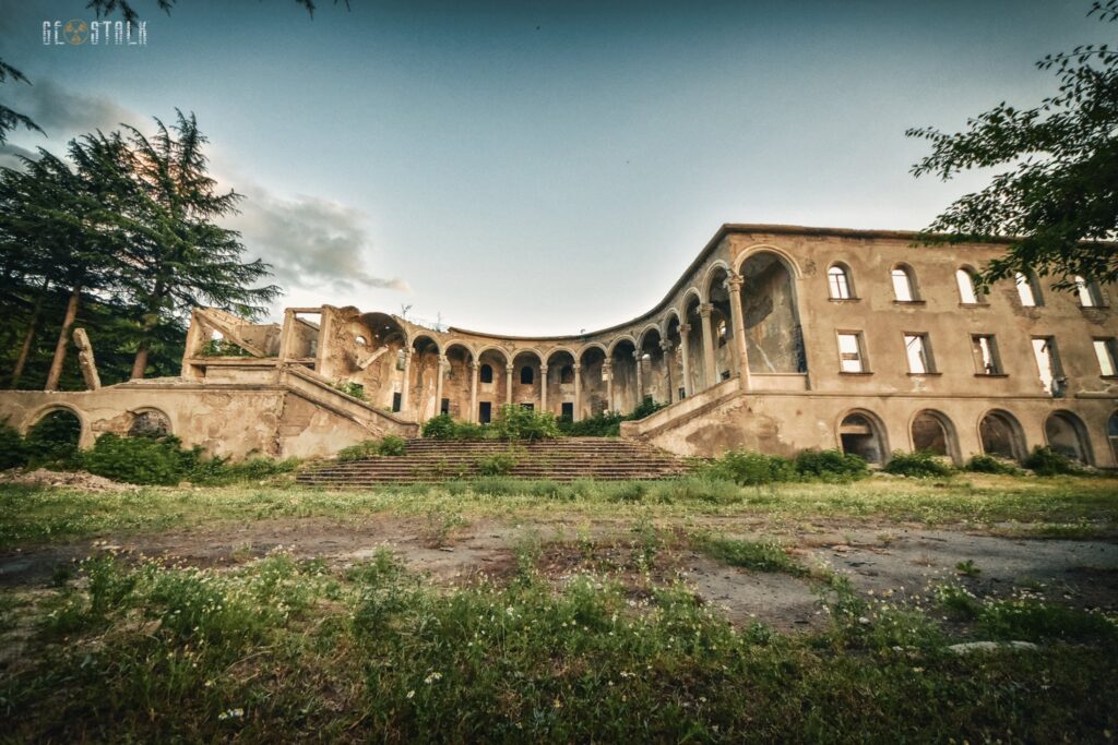
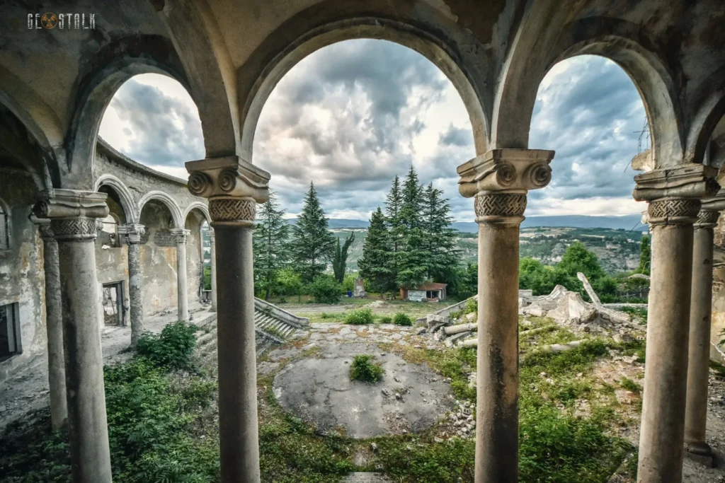
View on mapChiatura Pioneer Palace is located in Zemo Imereti, on the territory of the city of Chiatura. The Chiatura Pioneer Palace was built in the early 60s of the 20th century. According to the standard project of architect Chkheidze. There were 3 such buildings in total on the territory of Georgia. One in Chiatura, the second in Tkibuli and the third in Tkvarcheli. Scientific and artistic circles were held in the building. Numerous events were held and a museum was also arranged. The building functioned until 2007, after which it was completely abandoned. Over time, it was looted and damaged after the impact of natural events and became dilapidated. In 2014, the dismantling of the building began, which was stopped by civil activists. Today, a small part of the building has been preserved, namely the colonnade and the vestibule on the first floor.


Katskhi Pillar
Remains one of Georgia’s most mysterious sights. Located 11 kilometers from the city of Chiatura in western Georgia and 220 km from Tbilisi, it towers over the gorge of the Karshuna River. This natural 40-meter-high limestone column has been standing for centuries as a silent witness of history and has itself been the inspiration of endless lore among locals.
The first historical reference to this column was provided by the 18th-century Georgian historian and geographer Vakhushti Bagrationi. He theorized that the pillar, which had already been long abandoned in his day, had served as a temple of fertility during the country’s pagan era. Soon after the Christianization of the land in the 4th century, the pillar became a symbol of this new religion. A carved cross at the bottom of the column dates back to the 6th century and seems to support this assumption of Katskhi Pillar.How it was built upon such a high precipice without the aid of modern equipment remains a mystery.
In 1944 a small group of alpinists and archaeologists climbed the abandoned Katskhi Pillar. Upon reaching the top, the expedition discovered the ruins of two churches dating back to the 5th-6th centuries, cramped living quarters for monks, a few qvevris and the bones of a long-deceased stylite, now commonly referred to as the Katskhi Pillar skeleton. Upon such a discovery, scientists started actively exploring the site, and additional expeditions and archaeological excavations were organized.
One of the most interesting artifacts found on the pillar is a limestone plate dating back to the 13th century. On the plate is an inscription stating that a man named Giorgi built three cells for monks at the top of the pillar in order to gain absolution for his sins. Historians, however, remain baffled by the pillar and its monastic remains –while most historians agree that the pillar was abandoned by the 15th century, it is still unknown precisely when and why the stylites deserted the pillar.
Katskhi Pillar remains one of the most isolated and unusual churches on the planet, a memorable must-see for anyone passing through western Georgia
View on map
The Katskhi Monastery of Nativity of the Savior
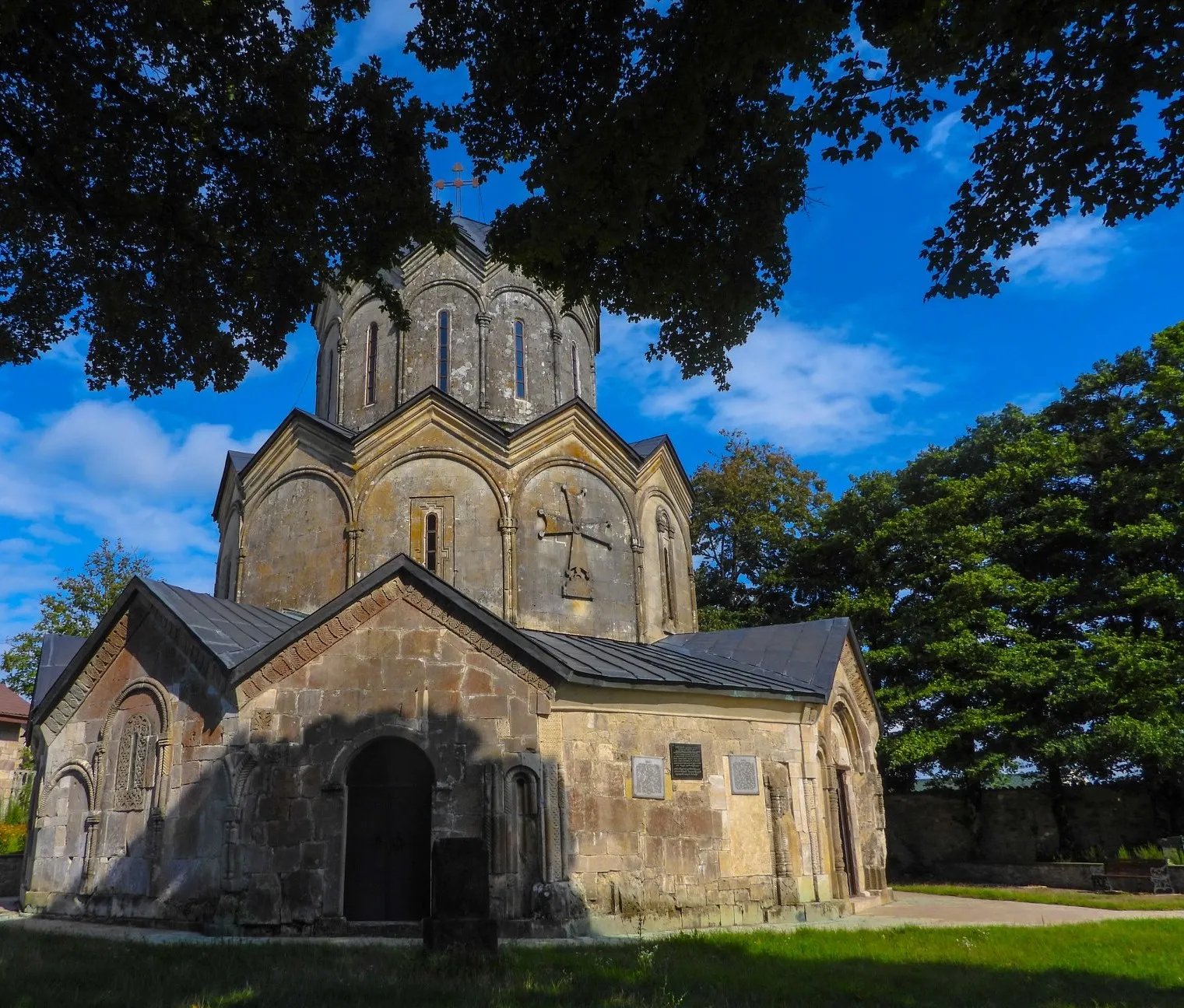
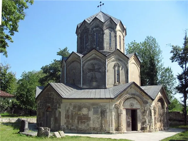
More commonly known as the Katskhi Monastery is a medieval monastery in Georgia, located in the village of Katskhi near the town of Chiatura. It was built at the behest of the Baguashi family in the period of 988–1014. The church building is noted for a hexagonal design and rich ornamentation. Closed down by the Soviet government in 1924, the monastery was revived in 1990 and is now operated by the Eparchy of Sachkhere and Chiatura of the Georgian Orthodox Church.
The exterior of the church features three gradually narrowing cylindrical levels formed by the faceted gallery, the main body of the church, and the drum of the dome.
The six apses are inscribed into the outer polyhedron and surrounded by an ambulatory from all sides. An inscription from the ambulatory mentions the certain “Tskhovreba, daughter of Ioann, Duke of Dukes”. A single spacious interior compartment around the subdome bay includes radially oriented semi-circular apses. One of these, the altar apse, projects outward prominently due to its large bema. The drum of the dome is also faceted. Each facet of the main body of the church as well as that of the dome and gallery terminate in a pediment with three lines of polygonal cornices.
The building was richly ornated, but the decoration of two upper tiers was lost in the process of the 1854 restoration. Of note is a large composition in relief at the southern vestibule of the gallery, the Exaltation of the Holy Cross, featuring a cross supported by four angels.
The church is surrounded by a pentagonal wall, which contains a free-standing bell tower in its eastern corner. These structures are later additions, probably from the 17th or 18th century
View on map
Mghvimevi Monastery
An important monument of the XIII century in the gorge of the river Kvirila, near the village of Mghvimevi, Chiatura municipality, in the Imereti region. The monastery is located in a rock cave on the right bank of the river Kvirila. This rock is followed by a path that crosses the monastery yard and is cut into the rock horizontally. This trail ends at the main cave, at the entrance of which a large and a small church are built, while in the past it continued to the west and was a special entrance to the rows of caves.
The monastery complex includes a two-nave basilica of the Savior, a small hall church, a bell tower, and a convent for nuns. Behind the central temple is the Cave of the Mghvimevi, where services are held on major holidays.
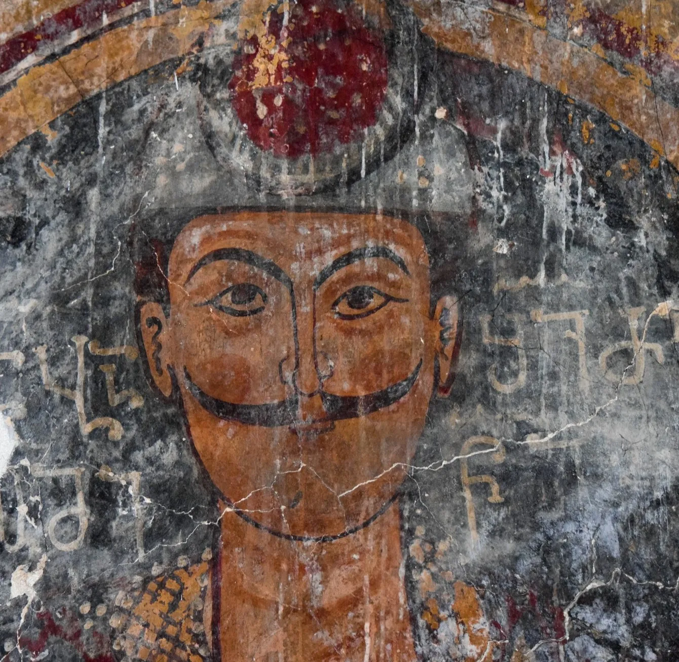
the main temple is named after the Savior. One of the sights of the temple is the wooden iconostasis, which is entirely painted. It is a two-aisled basilica whose naves are separated from each other by arches supported by massive columns. The facade of the building is decorated with very luxurious carvings. Here we can find carvings around the window, monumental crosses, interlocking rhombuses, cornice carvings, etc. The door of the iconostasis is decorated with engraved plates, and at the top of it is a composition of the Savior and the Twelve Apostles, various episodes of his (Savior) life. There are frescoes on the wall of the church, including portraits of Rati – Eristavi of Racha, the founder of the monastery in the 13th century, of his wife Rusudan, and brother Niania Kakhaberidze.
Another attraction of the monastery is the small hall church. Its ceiling and west wall are natural rocks. On the east wall of this church, there is a bas-relief of a ram, and on the outside of the south wall, there is a fresco painting.
In the Mghvimevi cave was kept unique engraved icons and a magnificent pattern of wood carving, a vine door. At present, these items are preserved in the funds of the Georgian State Museum of Art. Mghvimevi Monastery is one of the most unique monuments of Georgia.
View on map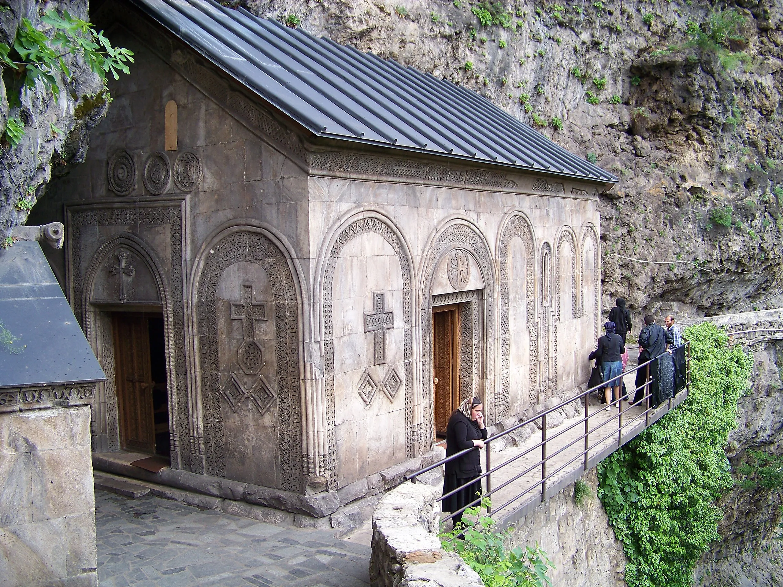


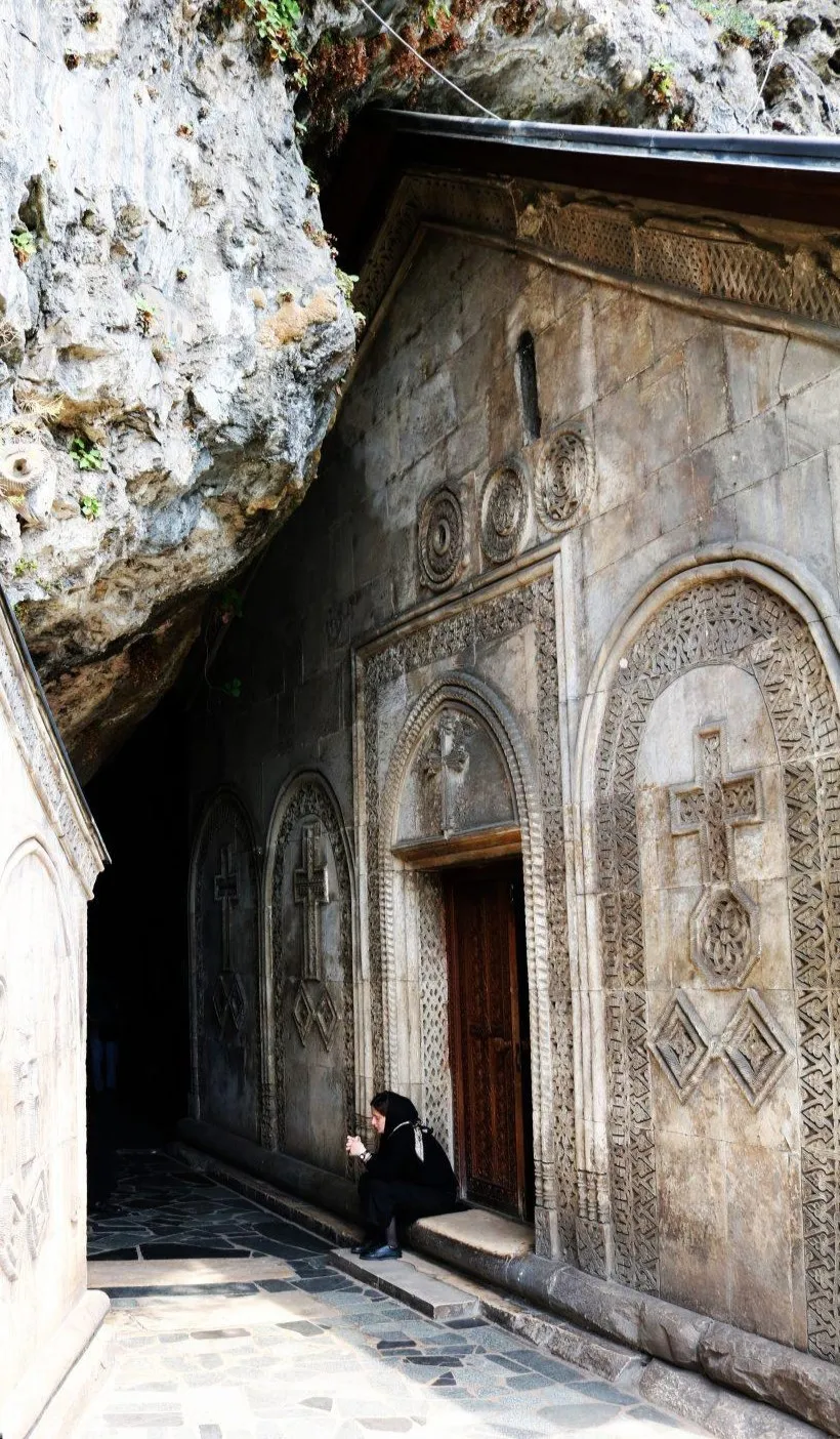

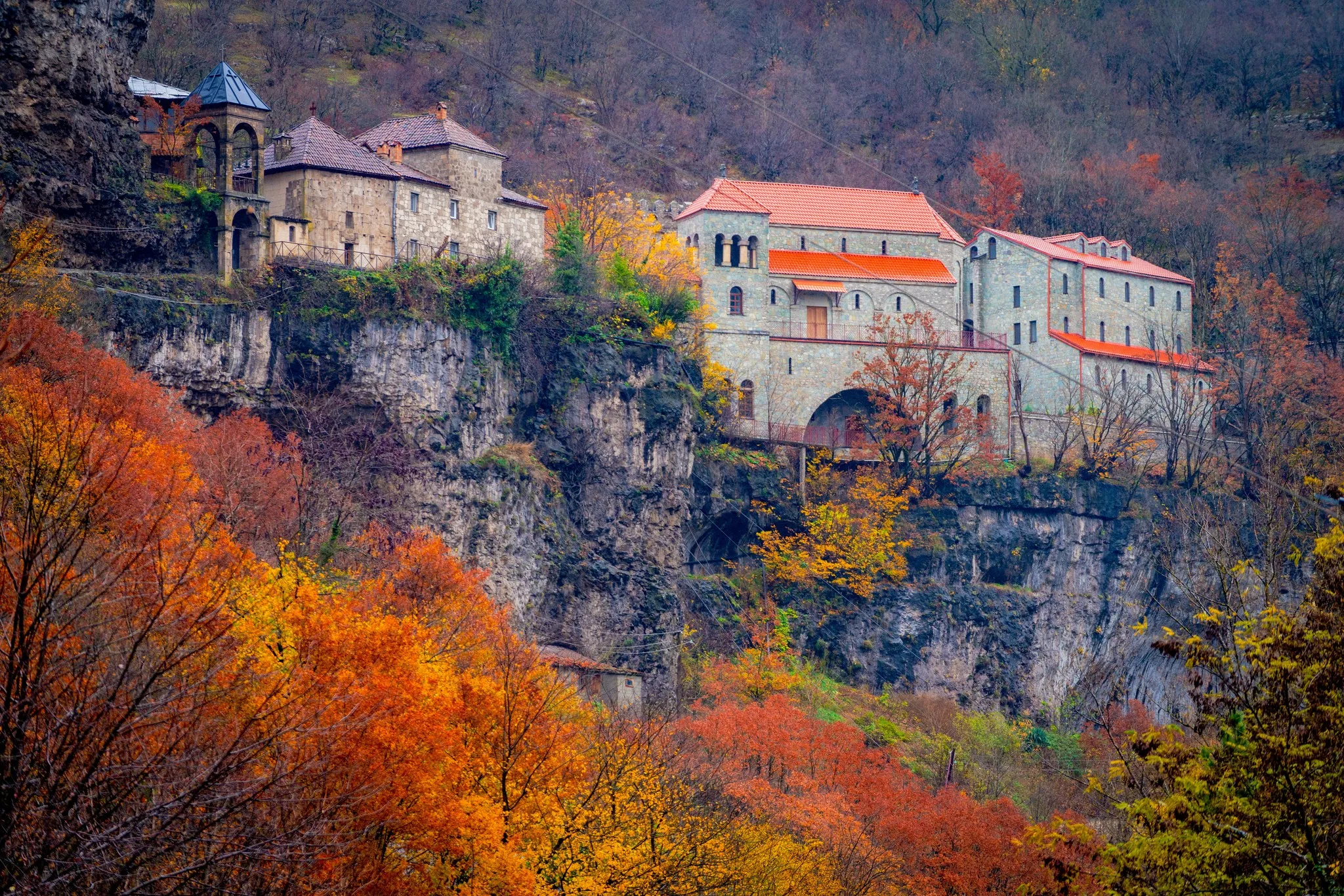
Church of St. George of Darkveti
Is located in Zemo Imereti, in the village of Darkveti, Chiatura Municipality.
The church was built at the turn of the 10th–11th centuries. Initially, it had a single nave, and then a transept was added. The church is tall and wide, with graceful proportions. It is plastered inside. The interior of the church is divided by two pairs of pilasters and the vaulted arches of the arch resting on them. There is no decoration in the interior, the carvings are mainly concentrated on the facades, near the windows and entrances. Asomtavruli inscriptions occupy an important place in the decorative decoration of the facade. One of them mentions the builders of the church (someone named Goliath’s sons): Godalbri, Liparit and K-E. The window on the eastern facade is noteworthy, the light hole of which is divided into two by a small pillar. The church has a bas-relief of a peacock, which is foreign to Georgian architecture.
View on map
Perevisa St. George Church – a medieval church in the village of Perevisa, Chiatura Municipality.
The church was founded in the 9th century. Fragments of wall paintings from the 11th-13th centuries have survived. On September 7, 1920, the scientist Ekvtime Takaishvili visited the Perevisa St. George Church and made notes about it.
Another church was built in the same area at the end of the 19th century. The new church is much larger than the old one and is distinguished by the sophisticated architectural style of the buildings of that period. There is a construction inscription on the church, which dates back to 1893.
The church was demolished in the 20th century. Its materials were used to build collective farm buildings. Over time, the arches and ceiling of the ruined church collapsed from prolonged rains, the frescoes were destroyed, and the icons were scattered. Nevertheless, fragments of the walls and old frescoes have been preserved.
The first restoration works were carried out in 1991-1993. A more extensive restoration began in 2005. In the same year, church services resumed in the temple. Archaeological excavations were carried out in the area surrounding the old church. The restoration works have not been completed for a day.
View on mapSveri Adventure Camp is an innovative project in Georgia, which combines various extreme adventure activities around one location; in particular, the following activities are available in the camp: rock climbing, cycling, cave tour, hiking, canyoning, rafting, zipline.
In Sveri Adventure Camp, located in Imereti, in a fabulous nature, you can have one of the most impressive vacations in life and experience real adventures with friends and family.
In our well-equipped camp, you will find wooden cottages, a campsite with places for tents, recreational and children’s spaces, areas for a picnic, bonfire, cooking, dining and shower, sports equipment rental point. But the most interesting thing is that our professional guides will guide you to the adventure spots in Imereti, located around the camp, where you can visit the caves, go on a bike tour, take a boat ride on the lake, do rock climbing, canyoning, go hiking, enjoy stunning views, take unforgettable photos and get charged with emotions.
View on map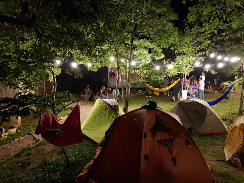

Sachkepia Waterfall is located in the village of Sveri, Chiatura Municipality, in the valley of the Sadzalikhevi River in the Imereti region. The height of its fall is about 15 meters. In a forested valley, surrounded by huge rocks and boulders, the waterfall creates a very beautiful sight. This place is perfect for a picnic and to escape the summer heat. A pond forms near the waterfall, where you can swim. It is about 500 meters from the highway to Sachkepia Waterfall, but you can also organize an interesting hiking trip from the village of Gundaeti, during which you will visit the Sachkinia karst cave, the Sadzalikhevi Canyon and the Sveri Fortress.
View on map
Ghurghumela Lake
is located in the Imereti region, in the Chiatura Municipality, in the vicinity of the villages of Skindori and Tsinsopeli, in the gorge of the Ghurghumela river, at 555 meters above sea level. It is a remnant of an artificially created reservoir. The shores of the lake are covered with aquatic plants. Lake Ghurghumela is surrounded by mountains and is a very beautiful sight, both in spring greenery and in the picturesque autumn. The stunning panoramic views and the rippling water amidst the open spaces attract many people. Boat trips on the lake and fishing are also possible here. If you want to unwind in the tranquility of nature, Lake Ghurghumela is a perfect place to do this.
View on map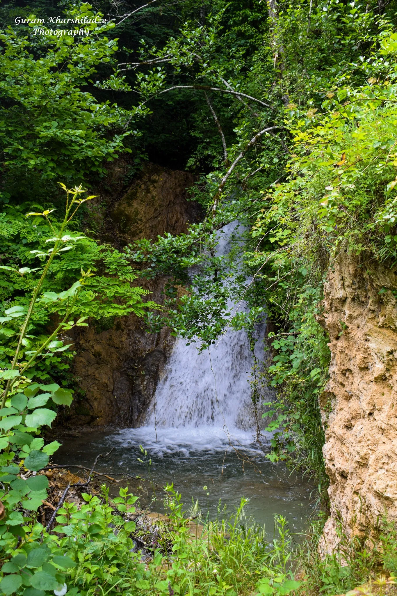
Navardzeti (Tiri) Waterfall
is located in Zemo Imereti, in the village of Navardzeti, Chiatura Municipality. 4 km from the city of Chiatura. Near the Tiri railway station. It is possible to get there from the city of Chiatura, leave the car on the other side of the road and cross the Bondi Bridge to the other side of the river, where it is located near the railway, 50 meters from the Tiri Church.
There is a picnic table on the river bank near the waterfall, as well as a spring.
View on mapThe Navardzeti (Tiri) Assumption of the Virgin Mary Complex
Is located in Zemo Imereti, in the village of Navardzeti, Chiatura Municipality, on the banks of the Kvirila River, near the “Tiri” railway station. It can be reached from the side of the city of Chiatura, by crossing the Bondi Bridge.
The temple must have been built in the 12th-13th centuries (possibly the 11th century).
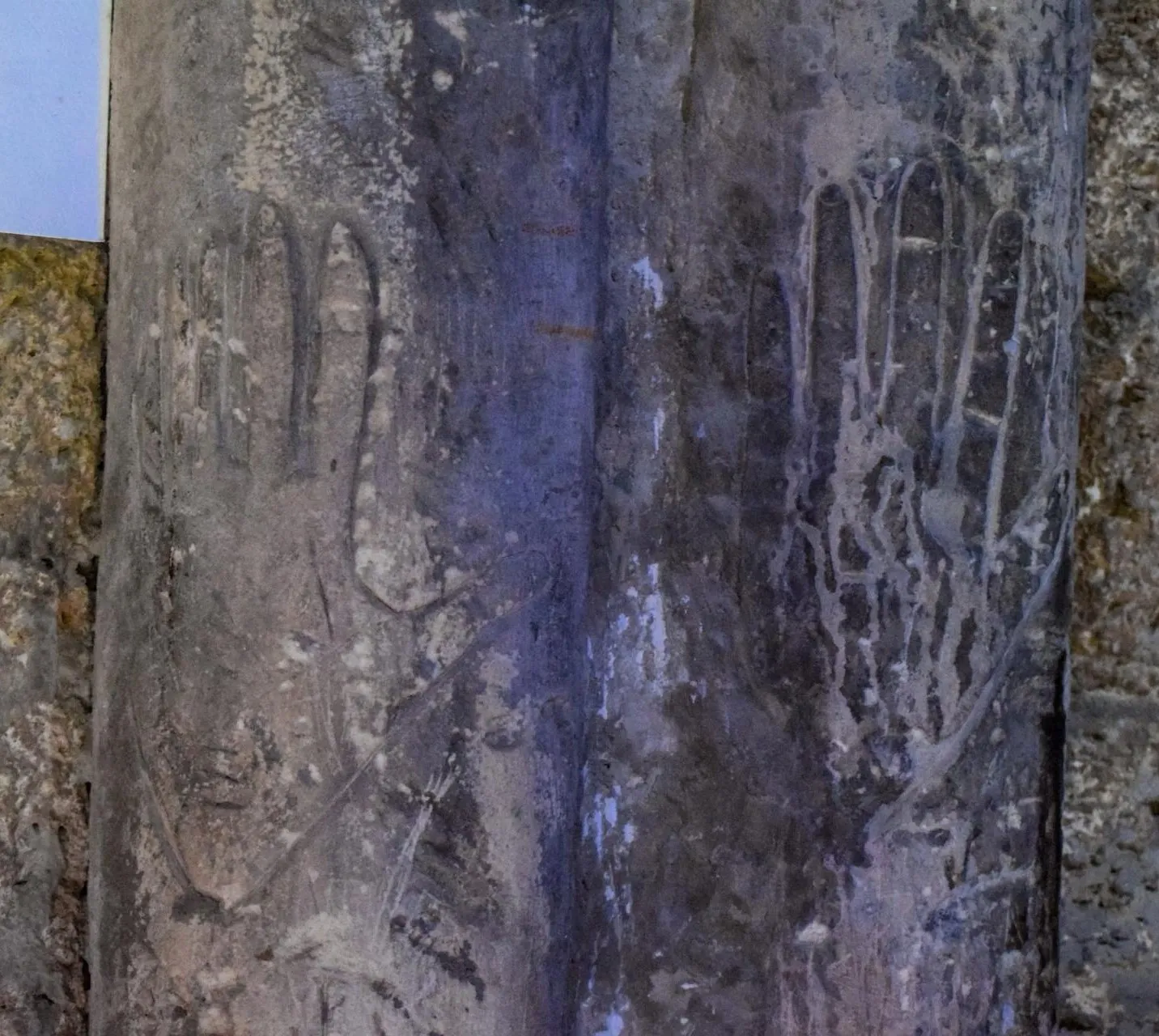
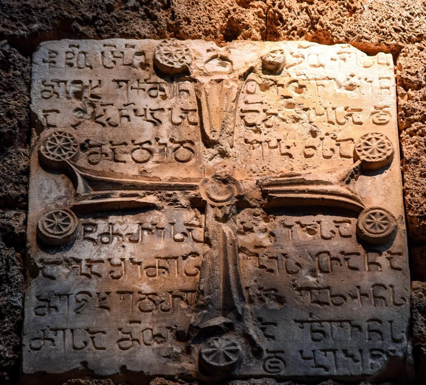
The church is a single-nave hall basilica, built of yellowish-blue shale stone and lime, on the wall column in the temple there are probably handcuffs carved by the master builder (both left). The temple also has two inscriptions from the time of the later restoration.
Near the temple there is a complex of caves carved into the rock. In one of the caves, which even has a window, there is a carved hole (shaped like a hare). During archaeological research of its bottom, artifacts typical of the 5th-6th centuries were found – fragments of clay vessels and stone flakes.
View on map



The Church of St. George of Navardzeti is located in Zemo Imereti, on the outskirts of the village of Navardzeti, Chiatura Municipality, on a cape, one kilometer from the cemetery.
The church was built in the 12th-13th centuries. It is currently being restored.
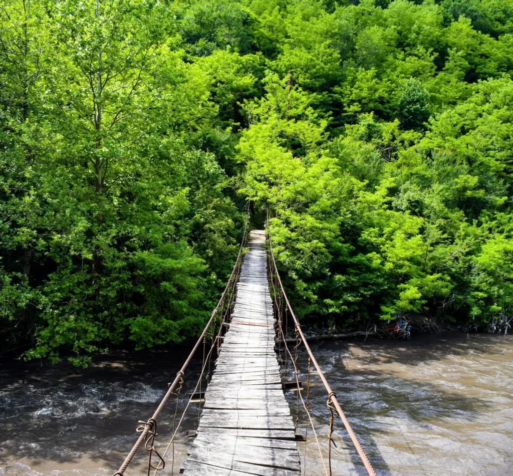
The Navardzeti (Tiri) Bond Bridge is located in Zemo Imereti, near the village of Navardzeti, Chiatura Municipality. The bridge leads to the Tiri railway station, where there is a complex of the Virgin Mary, a waterfall and a castle.
View on map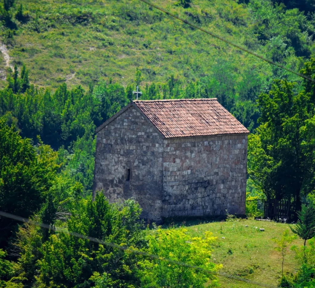
Tkibuli Municipality
Tkibuli is a city in western Georgia, Imereti region, administrative center of Tkibuli municipality. It is located south of the Nakerala Range, 590 meters above sea level.
Tkibuli (Tkvibuli) is first mentioned in historical sources in a monument dated 1259-1293. In the feudal era, Tkibuli belonged to the Agiashvili family. In 1825, a coal deposit was discovered. Coal mining began in 1846. In 1887, the Kutaisi-Tkibuli railway line was laid and coal mining reached a significant scale. On September 20, 1939, the town of Tkibuli was created as a result of the unification of the village of Tkibuli and the town settlement of Tkibuli. Coal mining reached its maximum in the 1950s, when a coal enrichment plant was built. In the 1980s, 4 mines were operating. The main consumer of coal was the Rustavi Metallurgical Plant. After the collapse of the Soviet Union, coal mining in the mines practically ceased, and the coal enrichment plant was destroyed. In 2006, coal mining was resumed in two mines, and the coal enrichment plant was renovated.
Nowadays, a museum, theater, art gallery, libraries, and other cultural and educational institutions operate in Tkibuli.
The region has great tourist potential, due to its beautiful nature and abundance of cultural monuments. Must visit places are : The Mukhura waterfall hidden in the greenery, the mystical Tsutskhvati cave, or the Tskaltsitela gorge, also historical and cultural monuments, of which the Gelati Monastery is especially noteworthy.
Gelati Monastery
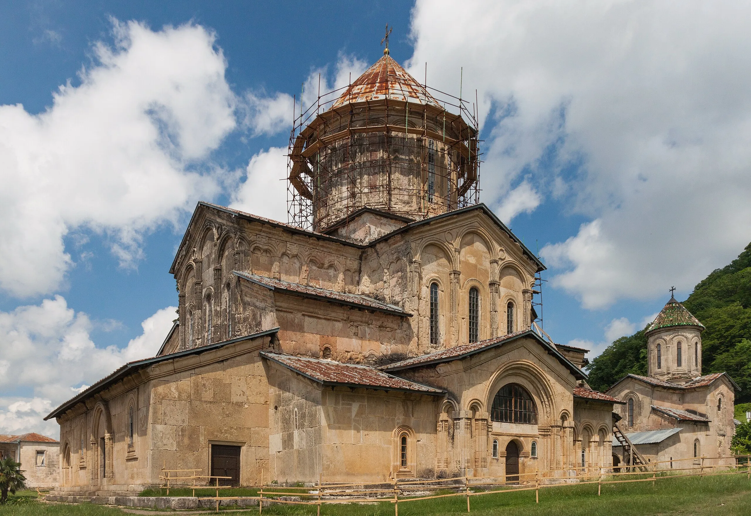
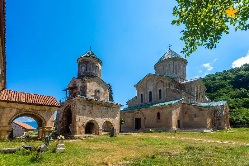
Gelati Monastery is located in the Imereti region, 11 km from the city of Kutaisi. The monastery was founded by David the Builder in 1106. It is here that the greatest king of Georgia is buried.
The ensemble includes the main cathedral of the Assumption of the Virgin Mary, St. George’s Church, St. Nicholas’ Church, the bell tower, the academy and the fortress. Gelati Monastery was a major cultural and educational center.
David did not manage to complete the construction of the monastery during his lifetime, and his son Demeter continued the work he had begun. In the 12th-15th centuries, Gelati Monastery was granted complete autonomy, recognizing only the supreme right of the king, and even the Catholicos-Patriarch of Georgia did not have any governmental power. After the political collapse of Georgia, Gelati Monastery passed into the hands of the kings of Western Georgia. On November 23, 1510, it was burned down by the Ottoman army that invaded Imereti. The kings of Imereti, Bagrat III and Giorgi II, restored the Gelati Monastery and donated new estates. Bagrat III was called the “rebuilder” of Gelati. In the second half of the 16th century, the residence of the Catholicos-Patriarch of Western Georgia was moved from Bichvinta to Gelati. From the 18th century, large-scale restoration work was carried out at the Gelati Monastery by Giorgi VI, Alexander V, Solomon I, Solomon II, and the bishops of Gelati. After the annexation of the Kingdom of Imereti to the Russian Empire, the monastery turned from a church seminary into a state institution. The Gelati Monastery possessed a rich collection of manuscripts and works of engraved art, which are currently preserved in museums. The Gelati complex is included in the UNESCO World Heritage List.
The Gelati Monastery includes several buildings, among which the main church of the Assumption of the Virgin Mary is dominant. It is a central-domed building.
The interior of the church is particularly impressive. The wide and high dome in the center is supported by arches extending from four arms. The arms of the cross, which form the central space, are designed differently. The main, eastern arm consists of a deep nave and a semicircular apse. To the right of the altar is the deaconry, and to the left is the sacristy.
The sides of the western part of the church are two-story, with a patronage on the second floor. At the patronage level, the altar also has a second floor, where the hiding places were located. The central space of the building is crowned by a wide, high, sixteen-windowed dome.
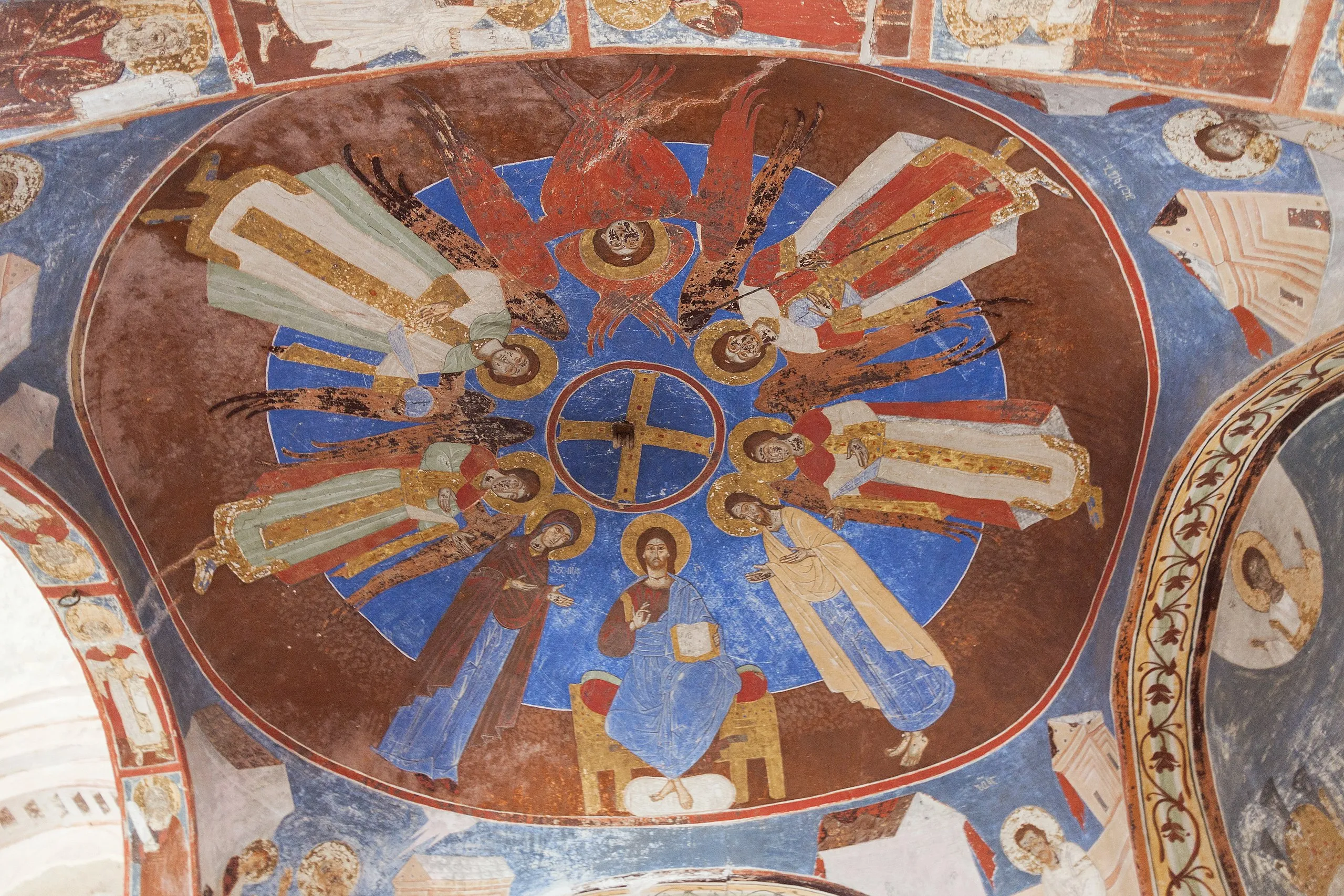
The Gelati Cathedral preserves important examples of Georgian monumental painting and mosaics.
To the west of the main cathedral, there is the two-story church of St. Nicholas and the academy building. There is an arched passage on the first floor of the church. This building is a pedestal, on which a small cross-shaped church is erected. The first floor is connected to the second by a stone staircase. The Gelati Academy building stands on a steep plateau. The entrance has a richly decorated four-columned gate. Through the gate we enter a huge hall. The building is rectangular in shape. There are stone benches along the walls, which were intended for the students of the academy.
The bell tower is three-story. The first two are contemporary with the monasteries, the third is built relatively later, in the 14th century. Water is drawn from the first floor. Historical sources inform us that previously water was supplied to all chambers and stalls through pipes.
To get to Gelati Monastery, you need to travel to Kutaisi.
View on map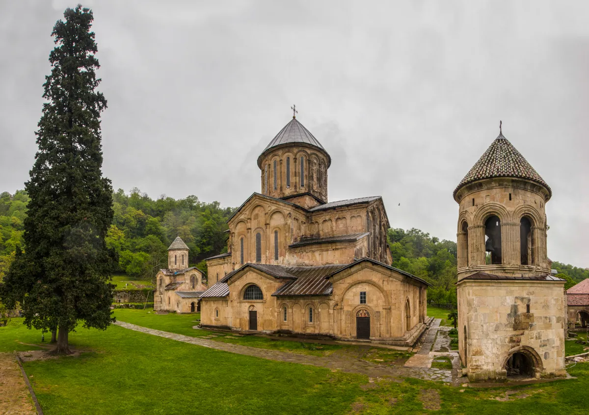




Sokhasteri Monastery
Is an architectural monument in the village of Gelati, Tkibuli Municipality, 200 meters northeast of the Gelati Monastery, on an elevated site. It dates back to the 12th century, and also includes construction layers from the 16th century.
“Sokhasteri” was a name of a natural or specially constructed building where monks lived a solitary life.
The monastery ensemble includes the Church of the Savior, a three-story building, various purpose-built buildings, and a fence. The Church of the Savior is a hall-shaped building, with southern and northern apses and a western narthex and a stoa-gallery. The temple was built in the 12th century, and the narthex and gallery in the 16th century.


Tskhrajvari
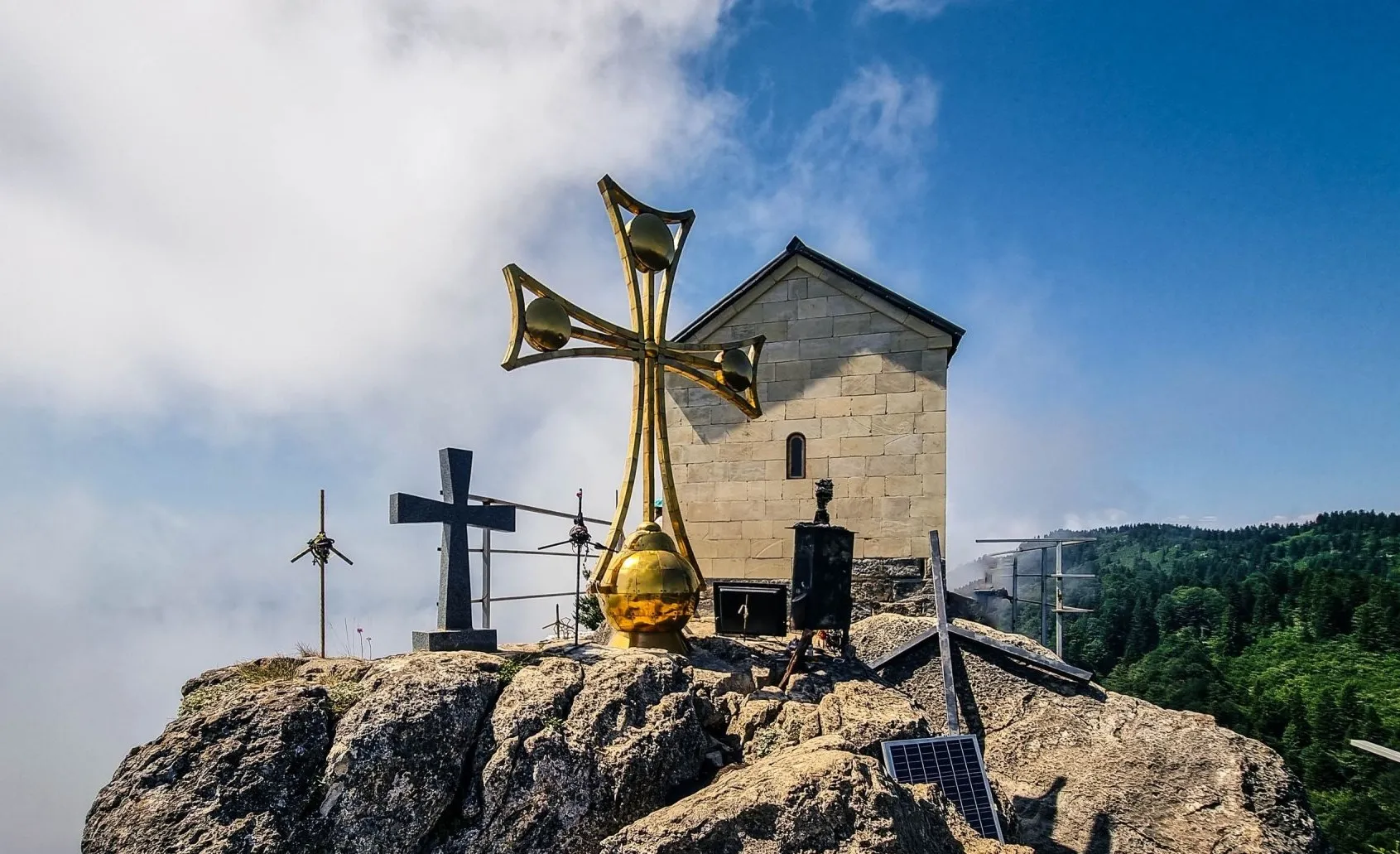
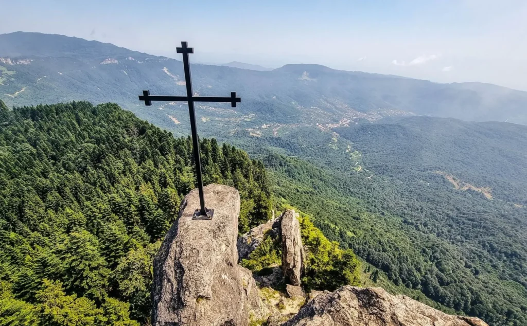
Literally nine crosses, a shrine of St. George, is located in the Imereti region, near the Nakerala Pass, on the top of a mountain near Tkibuli, at 1500 meters above sea level. Tskhrajvari is well-known for its striking form and the legends surrounding it. Thousands of pilgrims (and regular tourists) are drawn to the spot every year, especially on the last Saturday of May, when the traditional Tskhrajvaroba celebration occurs.
The site is special precisely because it’s not a traditional building with icons and relics. Instead, it is an open-air complex comprising crosses of various sizes. A particular standout is the massive golden cross with lily-like ends characteristic of Georgian traditions standing in the middle. The other crosses are simpler, made of dark metal with a more modest design.
The mountain peak where Tskhrajvari stands is popular among both pilgrims and regular hikers due to the stunning views of western Georgia. On a clear day, one can see the Colchis lowlands, the Black Sea, and the snowy peaks of the Caucasus from here. However, the high-altitude location is known for rapid weather changes, with fog often descending unexpectedly and lingering for a considerable time.
Tskhrajvari Cave marks an important archaeological discovery near the main site. The cave consists of several chambers, with a total length of 460 meters. Its interior is notable for uniquely shaped stalactites and stalagmites. Researchers have also found paleo-zoological materials, adding to the historical importance of the cave itself and the entire Tskhrajvari area.
View on map


Tsutskhvati Cave
Iis located in the Imereti region, in the village of Tsutskhvati, Tkibuli Municipality, at an altitude of 320 meters above sea level. Tsutskhvati Cave is one of the first in the world in terms of its antiquity and number of floors. It consists of 13 floors. The first floor is a narrow hole impassable to humans, in which a constant stream flows. The second floor is a huge natural tunnel. Springs, a small lake and calcite droplet formations are found in the branches of the Talani River. Pillars fixed by man – the remains of an ancient cult structure – have been preserved near the ceiling. Archaeological monuments from the Middle Paleolithic to the Bronze Age and the Middle Ages have been found on the higher floors. The bones of about forty species of animals have been discovered in the Tsutskhvati Cave. Of note is the Bronze Cave on the 5th floor, which records the climatic changes that have occurred over the past 140,000 years. Primitive cult objects were found on the 11th floor: specially arranged cave bear skulls, femurs and teeth, and bones of other animals sacrificed as sacrifices. The caves on the 7th-9th floors bear signs of being used as fortresses during the feudal era – whitewashed walls, carved steps, and fragments of pitchers have survived. A large colony of bats is found in the cave. Tsutskhvati Cave is one of the most important monuments with its diversity and archaeological significance.
View on map
Natural monument of the Tskaltsitela Gorge
In the Imereti Region of Georgia, at 130-200 meters above sea level, a red-colored river flows. Scientists will explain that such things are not surprising during floods, if the red river flows in the bed of the earth and washes it up. However, people tell another story – the river turned red after the famous battle of Khresili, when it was stained with the blood of Georgians who fought for the freedom and integrity of the country. The Georgians won the battle, and the river ran red.
Different types of fish live in the river, such as trout, barbus, barbel, mursa, different species of carps, danube bleak, and others. From the bank of the river, you feel the presence of a jackal, otter, and nutria. In winter, ducks, geese, and other aquatic birds make a spectacle.
Visit the Tskaltsitela valley, especially in early autumn, when the colors of the leaves in the Colchis forest change and nature creates art on the mountains.
View on map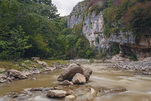
Motsameta Monastery
Is located in the Imereti region, in the Tkibuli municipality, near the village of Motsameta. It was built in the 11th century, although it acquired its current appearance in the 19th century. The history of the monastery’s founding is associated with the names of the Argveti princes – David and Konstantine Mkheidze. In the 8th century, during the invasion of Murvan the Deaf, they put up great resistance to the Arab commander, and were eventually martyred. The Georgian Church canonized them as saints. The relics of the saints who were martyred for their homeland and faith were originally buried in the ruined Church of the Annunciation. Bagrat IV built a small domeless church on the site of the church destroyed by the Arabs and transferred the remains of the saints to a new church. The name Motsameta is also connected with this history.
The Church of the Martyrs is a cross-domed building. All four arms of the cross are equal. The dome rests on four columns, two of which are the altar pillars. The peculiarity of the temple is the altar arranged to the north. This may be due to the fact that the relics of the saints were buried in the east – in a place of honor, so the architect moved the altar to the north. There are two entrances – to the west and south. The altar is separated by a 19th-century wooden pediment, on which stories from the Gospels and the lives of the saints are presented. On its left side, on an elevated place, on two carved wooden lions, lies a wooden ossuary in which the relics of the saints are placed. Painting has been preserved in the nave of the altar – a composition of prayers, which seems to have been done in the late Middle Ages. To the south of the church stands a two-story bell tower from the 19th century. The remains of two towers have been preserved on the territory of the monastery. The monastery complex is surrounded by a wall fence.


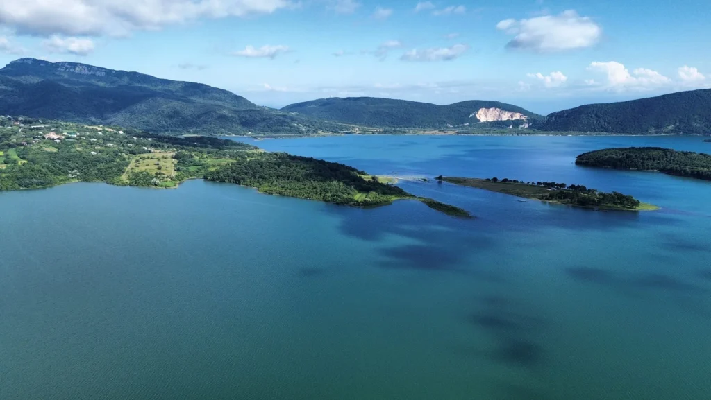
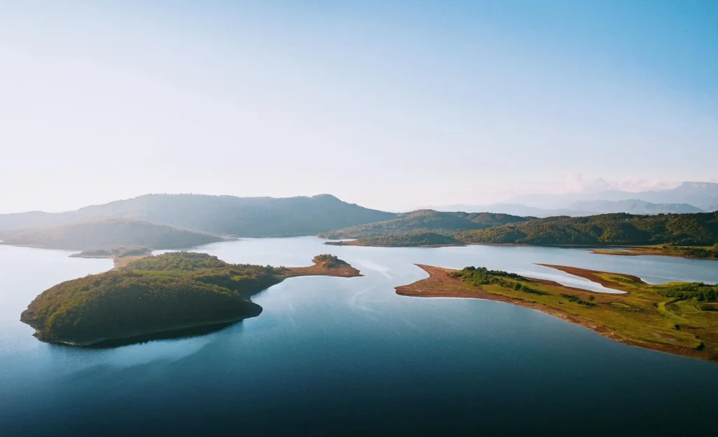
Tkibuli Reservoir is located in the Imereti region, in the Tkibuli municipality. It is surrounded by forests and is distinguished by beautiful views. Its area is 12.1 km², and the maximum depth is 12.5 m. The reservoir area is excellent for picnics, and you can easily find camping sites here. Tkibuli Reservoir is rich in fish, which is why it also attracts fishing enthusiasts. The reservoir is fed by water from the Tkibuli River and other tributaries, as well as atmospheric precipitation. It was created by an earthen dam, which dammed the Tkibuli River where it was lost in a karst shaft at the bottom of the cave.
View on map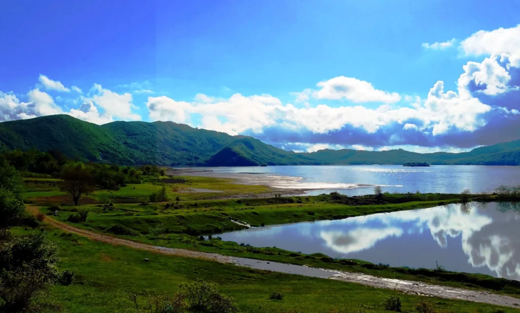
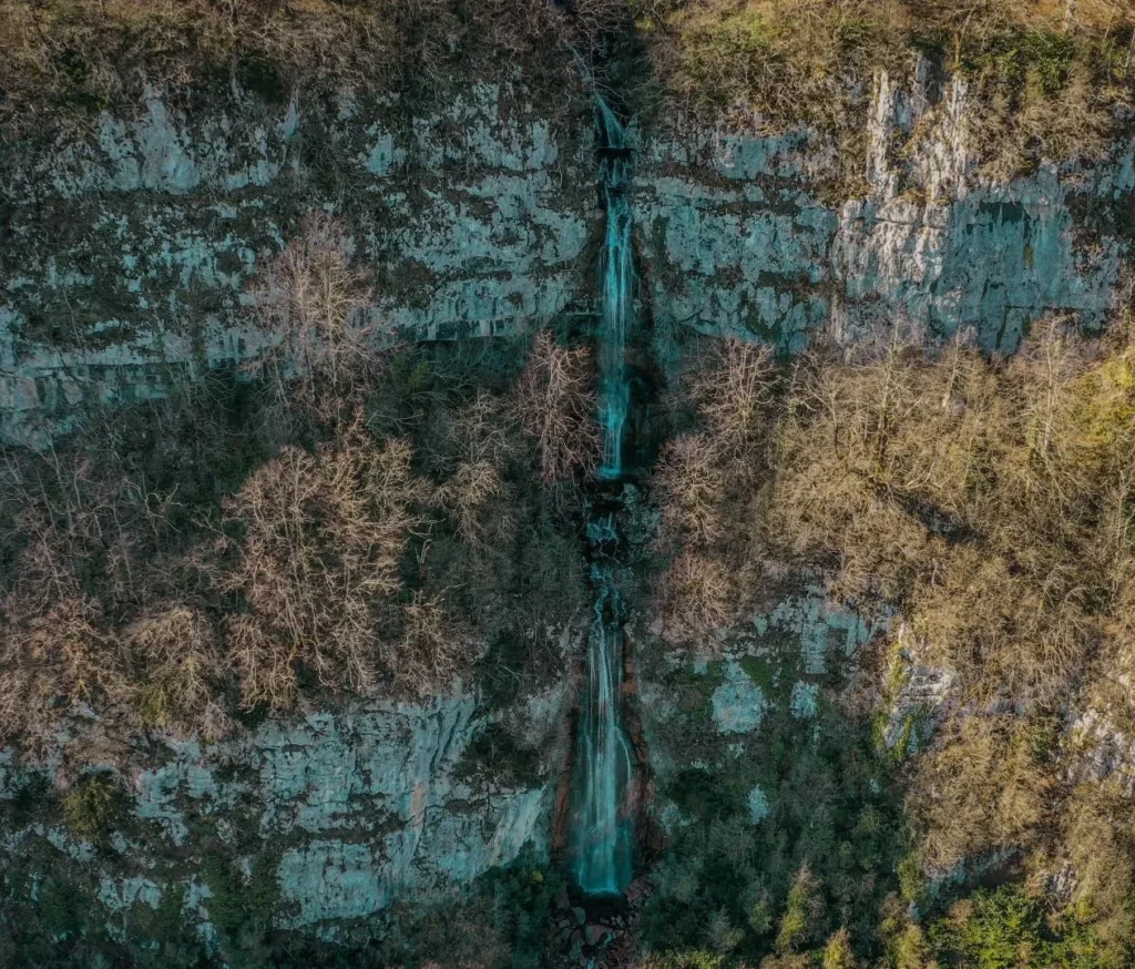
Mukhura Waterfall – a 60-70 m high three-tiered waterfall, flowing from a cave on a slope. Located in Tkibuli Municipality, near the village of Mukhura, near the Tkibuli-Mukhura highway, 886 meters above sea level.
View on map

Zestaponi Municipality
Zestaponi is a municipality in western Georgia, in the Imereti region. It was first mentioned in historical sources in the 16th century. In the 1920s, there was a Cossack army post here – Kvirila Post, and during the same period, Zestaponi was also called Kvirila. In the 1920s, for a short time it bore the name of the revolutionary Jugheli, but later it regained its historical name. In the 20th century, the opening of a ferroalloy factory led to the growth of Zestaponi, and it became one of the industrial centers of Georgia.
Zestaponi municipality is distinguished by its beautiful nature and abundance of cultural monuments. The Samtsvera waterfall is particularly popular, which is visited by many tourists and locals in the summer. In Zestaponi you will find many monuments of cultural and historical significance from different periods. The Shorapani fortress of the ancient period, built by King Parnavaz I of Kartli, is located here. According to Strabo, it was so large that the entire population of the city could freely fit inside it.
Irine Park
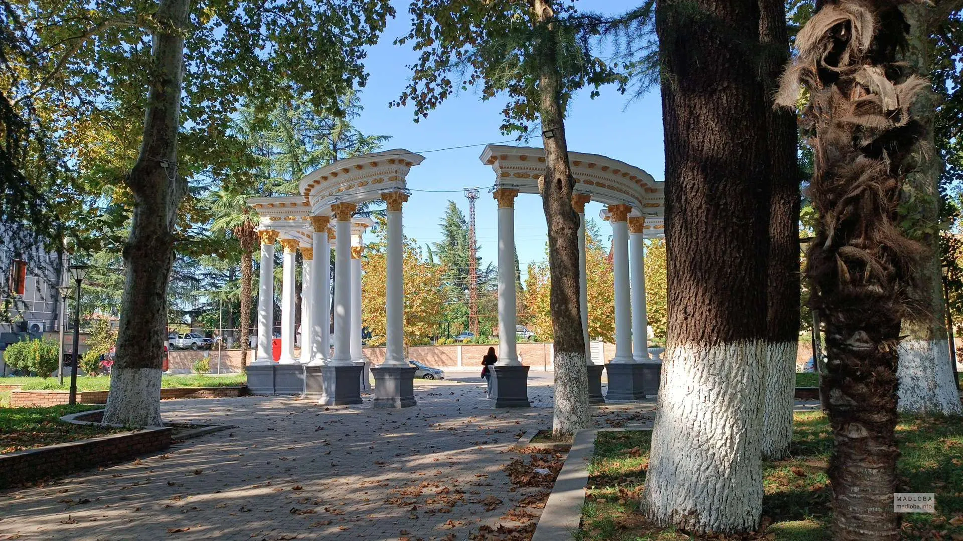
Is located in the city of Zestaponi, in the Imereti region, between Rustaveli and Agmashenebeli streets. Irene Park was built at the beginning of the 20th century by French architect Albert Jean, and named in honor of his Georgian wife, Irene. This park is one of the great places to relax in Zestaponi. Greenery, beautiful paths, fields, attractions and a sports field create a pleasant and cheerful environment for both adults and children. In 2011, the park was rehabilitated, and today it is a well-equipped and well-groomed place where you can spend time happily.
View on mapShorapani Fortress
Is located in the Imereti region, in the Zestaponi municipality, on the territory of the town of Shorapani. It was first mentioned in sources in the 1st century BC – 1st century AD by Strabo. According to him, the fortress was so large that the city’s population could freely move around in it. According to Leonti Mroveli, the fortress was built at the beginning of the 3rd century BC by the Kartli king Parnavaz I. In the 6th century, during the Iran-Byzantine war, Shorapani Fortress changed hands. It was an important strategic point in later periods as well. In 1730, the fortress was occupied by the Ottomans. In 1770, it was liberated by King Solomon I. Shorapani was a fortress-city. It was one of the connecting links between the western and eastern countries. The shipping route ended in Shorapani and the land route began. It provided merchants and travelers with caravanserais, food, land transport, blacksmith workshops, a market, and more. The area of the fortress-city exceeds 6,000 square meters. Two chronological layers are clearly visible in the remains of the fortress – the early and late feudal era. The fortress includes buildings from different periods. The fortress has two gates – in the northeast and west, where the old arched fortress tower is currently preserved. In the past, the entire territory of the fortress-city was surrounded by a brick wall, as evidenced by fragments of the wall and brick fragments.
View on map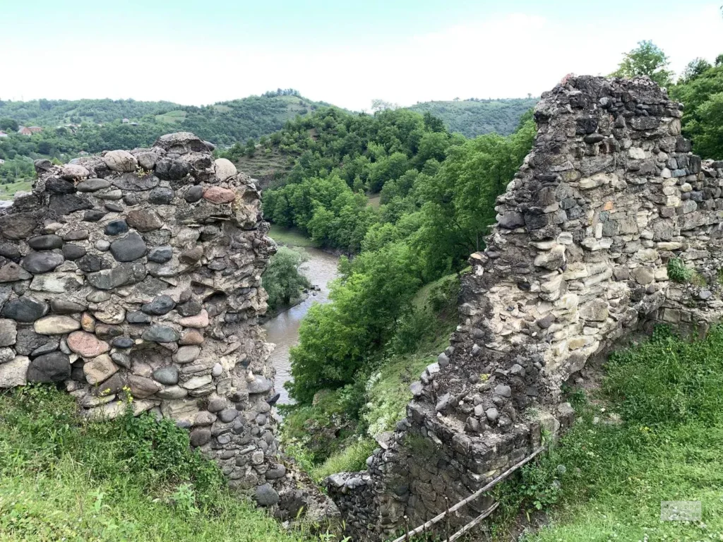

Sazano Castle
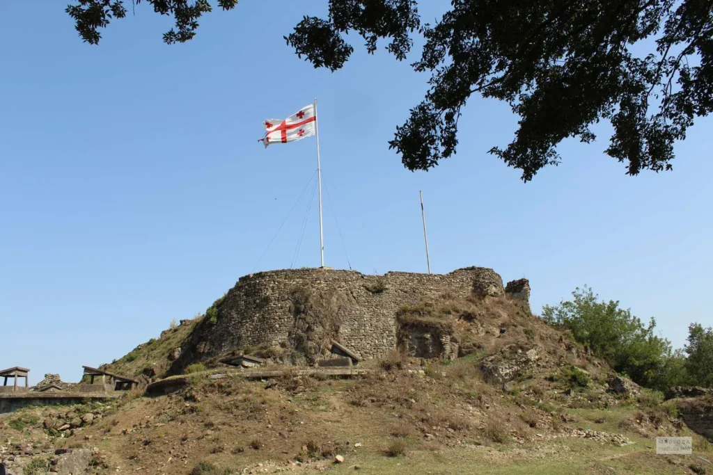
Is located in the village of Kveda Sazano, Zestaponi Municipality, in the Imereti region. The medieval castle was built on the slopes of a rocky mountain. The complex includes an old church and various purpose-built storage rooms surrounded by a wall. The earliest building is a two-nave church, built on a pedestal about 2.5 meters high. The southern nave is separated from the main part by two well-crafted rectangular columns. The capital is decorated with a twisted ornament at the point of connection with the column. The church has entrances from the west, south, and north. The western entrance is cut into the southern nave. As can be seen from the remains, a tower was built for the church in the late Middle Ages. The temple is built of well-hewn stone. The wall also belongs to the late Middle Ages, which is built of smooth stone. Its width is up to 1.5 meters. There are several storage rooms enclosed within the fence, and drinking water is also available in the central part of the yard.
View on map


Samtsvera Waterfall – a waterfall in the gorge of the river Dzusa, east of the village Zovreti, southwest of the village Kveda Sazano, in Zestaponi municipality, Imereti, at an altitude of 170 meters above sea level.
The waterfall is visited by a lot of people during the summer. Here you can swim in the river Dzusa and also enjoy your time in nature.
An asphalt road passes near the waterfall. From the road to the waterfall, there is a hiking trail with a length of just 200 meters. Anyone can walk on the trail. Distance from Zestaponi -15 km.
View on map

Tabakini Monastery of St. George
Is an architectural monument, in the village of Tabakini, Zestaponi Municipality, Imereti Region
The Tabakini Monastery of St. George, built in the 7th-8th centuries, is distinguished by its architecture, 16th-century paintings, and rich history. The monastery, where 70 monks once served, has made a great contribution to the history of the country.
During the communist atheism, the temple and its paintings were damaged.
At the end of the 20th century, in 1992, monastic life was restored in Tabakini; through the work of the monks working here, the monastery complex was supplemented with the Temple of the Twelve Apostles (2000), wooden cells, a refectory, and other auxiliary buildings.
The monastery complex includes a two-nave church of the 7th-8th centuries, with a crypt and a glass building, which shows traces of restoration in the 11th century and later in the 16th century. In the 1620s, the ruined monastery was renovated and the church was painted by the Bishop of Kutaisi, Gerasime Chkhetidze. The church preserves an image of the founder, King Bagrat III of Imereti (1510-1565); a bell tower from a later period stands nearby. In 1980-1986, the church was roofed and restored.
View on map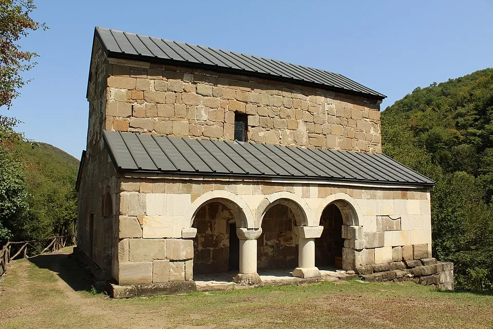

The Chalatke Three-Span Bridge
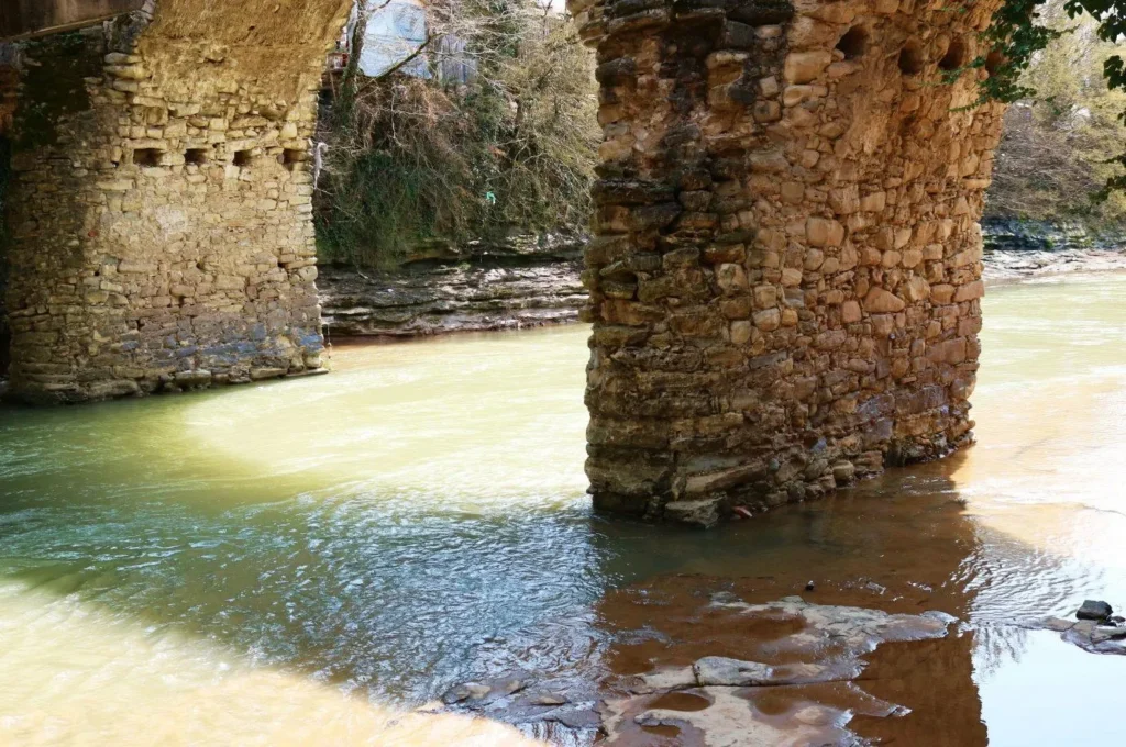
(Tamar Bridge) is located in the village of Chalatke, in the Zestaponi municipality of Imereti, on the right tributary of the Kvirila River – Cholaburi. It dates back to the Middle Ages. According to legend, the city of Baliastomi was built here, which began at the Queen Tamar Bridge and ended in the upper Sazano. The bridge is a three-span structure. Its middle span is higher than the other two. The carriageway of the structure is narrowest in the middle and widens evenly towards both ends. The upper edge of the carriageway forms a broken line on the facade, which descends from the center to the banks. The bridge is characterized by flexible lines, pleasant light proportions, which creates an aesthetic artistic look. Only a few multi-span bridges have survived in Georgia, therefore the Chalatki Three-Span Bridge (Tamar Bridge) is one of the notable and important monuments.
View on map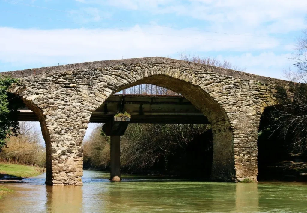
Terjola Municipality
Terjola is a town in Imereti, Georgia, serving as an administrative center of the homonymous district. Terjola is situated in the Imereti Lowlands in western Georgia, on the right bank of the Chkhara river. It lies on the Tbilisi-Zestaponi highway, 190 km northwest of Tbilisi and 14 km northwest of Zestaponi.
Terjola is first mentioned in the 17th-century sources. It acquired the status of a town in 1983. Terjola Municipality is distinguished by its diverse nature and abundance of interesting cultural monuments. Forests, beautiful waterfalls, and amazing, magical karst caves attract many nature lovers.
Gogni St. George Church
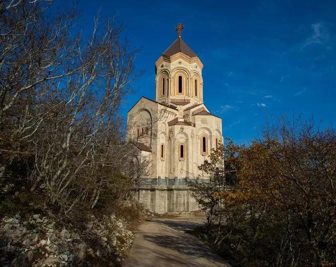
Is an architectural monument in the village of Gogni, Terjola Municipality. Gogni St. George Church is a hall-shaped building with a five-aisled apse. The church is built on a three-tiered plinth. It is faced with worked squares. The entrance is cut in the middle of all walls except the east one. There are three wide arched windows on the east side, one on the west, and two each on the south and north.
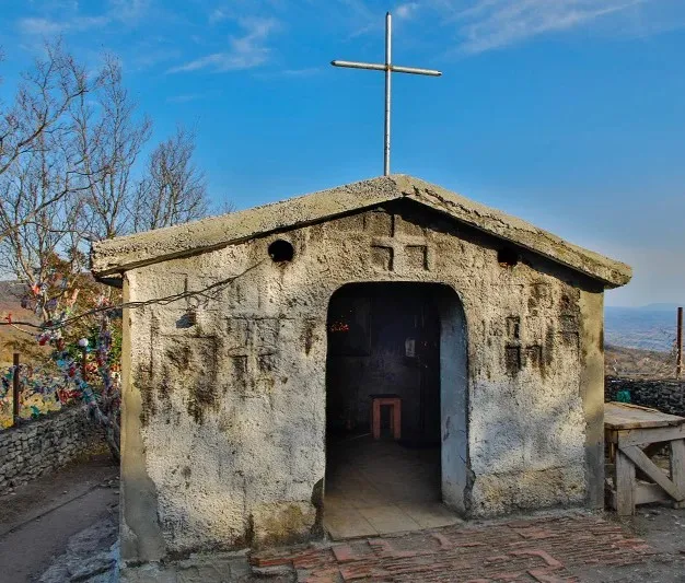
The shrine of St. George, located on Gogni mountain, is a monument of the VII-VIII centuries. This place is not only distinguished by its beauty, the shrine was also a carrier of great grace. As the legend tells us, all the men in the village of Gogni died and no one knew the reason. A resident of the village saw in a dream that you were looking for the cause of your misfortune in the river. Indeed, they took out the icon of St. George from the river and put it on a cart. The bulls climbed to the highest place and stopped there. They built a shrine on that very spot. It is also said that the door of the shrine was hung several times, but it fell every time. That is why it was called “Karugdebeli”( a church without a door). To celebrate St. George’s day, believers start climbing the shrine the night before. During the day, the flow of pilgrims from different regions does not stop. On May 6 thousands of believers visit the holy place.
View on map
The Skandi (Skanda) Fortress is located in the village of Skande, Terjola Municipality, in the Imereti region. It is assumed that it was built in the 4th century. The earliest mention of the fortress belongs to Procopius of Caesarea, who lived at the end of the 5th and beginning of the 6th centuries. The Skandi Fortress was one of the most important fortresses of the Kingdom of Egrisi. Its importance especially increased in the 6th century, it was an important strategic object during the Byzantine-Persian war. After the unification of Georgia, the Skandi Fortress lost its special role, although it continued to exist as a fortress. The fortress was razed to the ground by the hordes of Tamerlane, and then it was rebuilt by the Georgian king Alexander the Great. Since the 15th century, it has again occupied an important place. The royal palace is built here and Skandi becomes the summer residence of Bagrat VI. Until the 18th century, the Skandi Fortress was a reliable stronghold of Imereti. The last years of his life were spent here by the defeated Kakheti king Teimuraz I, who was defeated by Rostom Khan. In the 18th century, the fortress was abandoned, and in the 1830s, according to Dubois de Montperre, only one tower with a church and the remains of a stone palace remained. Today, the Skandi Fortress is in ruins. The fortress is inaccessible on three sides, and can only be accessed from the village. The fortress complex covers an area of 7,000 sq. m. Today, the eastern wall of the central building and the columned arch inside it have survived. This building is connected to the south by a fence, the foundation of which is visible only in one part; it must have extended to the northwestern tower, from where the tunnel begins. The central building of the fortress and the arches protected inside it are built of hewn stone
View on map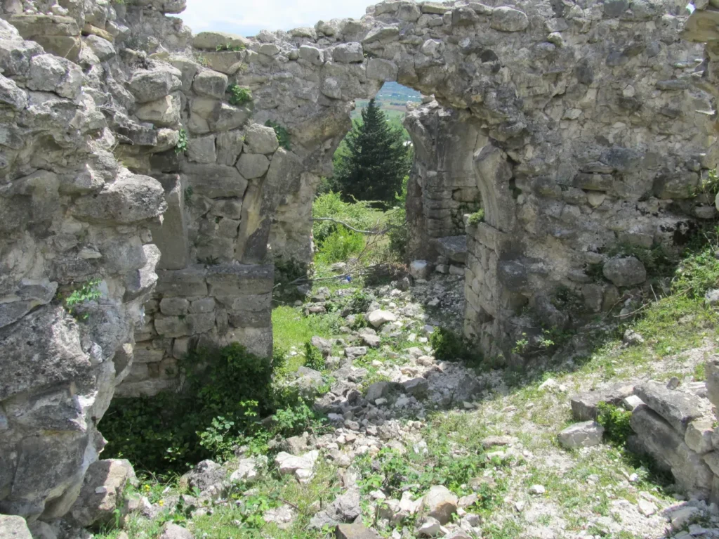

Kadagidze Rafi
A 4-meter-high waterfall in the Dzusa River gorge, in the village of Sazano, Terjola Municipality, Imereti. In the summer, when the water level drops significantly, you can see the entrance to a 25-meter-long cave. Next to the waterfall, there are also preserved dinosaur footprints, 7 such places are marked here. This place is very popular among local residents on hot summer days.
View on map

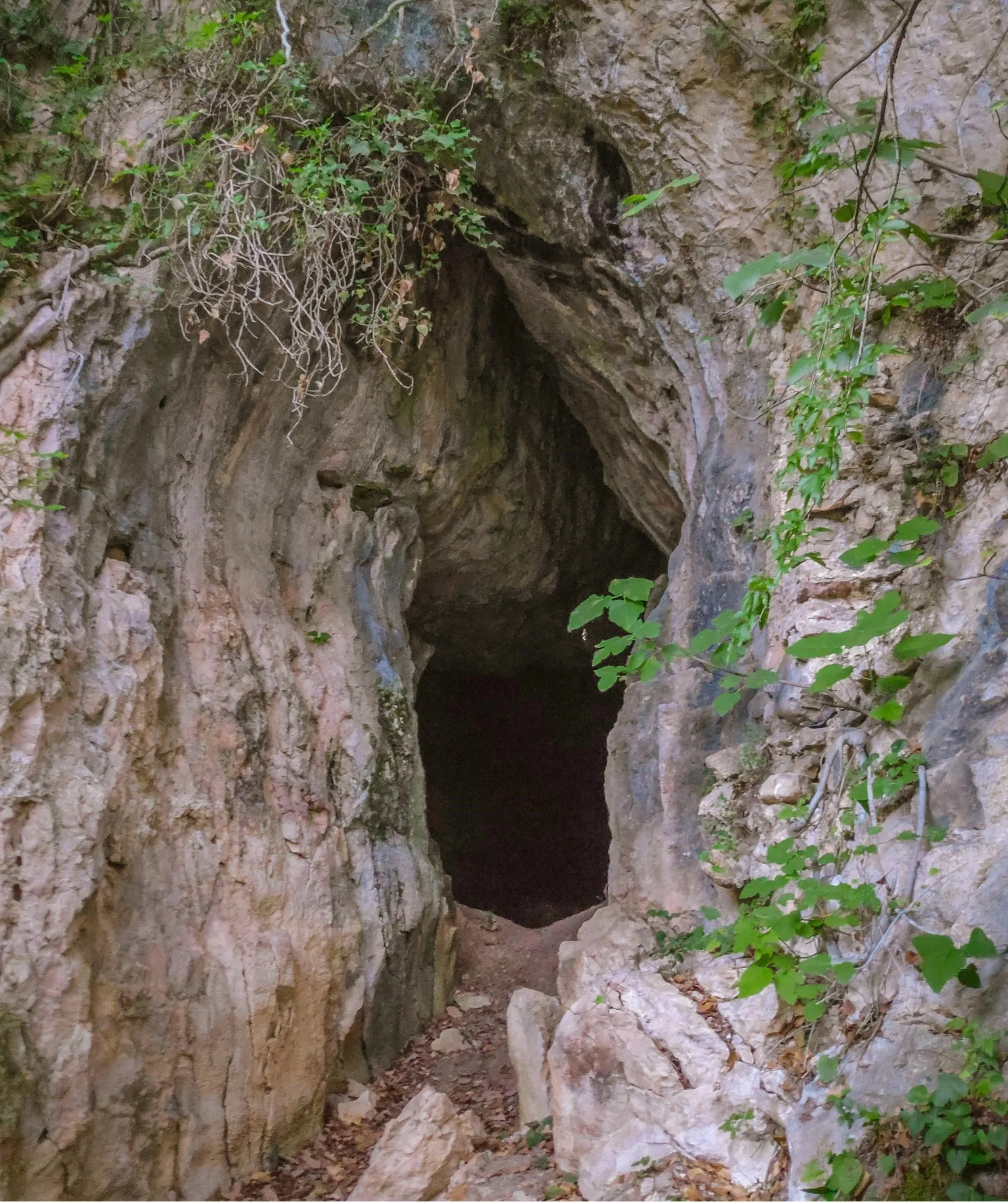
Mujireti Cave is located in the area of the village Mujireti, on the right slope of the river Zusa gorge, in Sazano, Terjola Municipality, Imereti region. The cave is created in upper limestone layers, the tunnel like deep space. It has one main corridor and short branches. In the deeper place it gets narrow and is impossible to continue walking. The entrance to the cave is 275 meters above the sea level, and 15 meters above from the river Dzusa level. The Maximum depth is 92 meters, project length 72 meters, minimal wide 1 meter, maxim width is 4 meters. Maximum height 3.50 meters, minimal height 1 meter. The bottom area is 98 m2, total volume is 117 m3.
The cave is poor with chemical precipitation, its dynamic, dry, the inhabitants are spiders, bats. At the entrance there is a wall built, and also in the middle of the cave there is a door built, and if you go deeper you will see that there is an entire wall built, the part of which is destroyed today. The cave is easy to pass, a plan was made for the cave. Mujireti cave was researched by Zaza Lejava in 1990. To the cave leads a car road, the last several km of the road are the village road, but any type of car can pass the road. The cave is 200 meters away from the road, which leads to a trail. Both the trial and the cave are easy to pass and every person willing to pass it can visit it. Distance from Terjola 20 km. From Kutaisi 50 km.
View on mapThe Godogani Arch Bridge is a unique architectural structure located in the idyllic village of Godogani, Terjola Municipality, Imereti Region. Although the bridge is not used for functional purposes today, it represents an important part of the region’s history and culture. This single-span arch bridge was built with both regular and irregularly cut stones, creating an impressive feat of engineering. Its design prominently features large stones stacked horizontally, providing strength and stability. The arch of the bridge’s towers rests on strong wall supports anchored to the rock, and a metal column is incorporated into the structure for greater stability.
View on map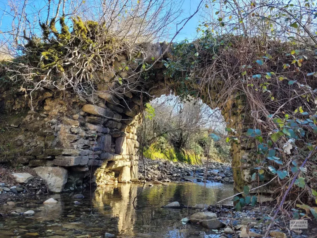
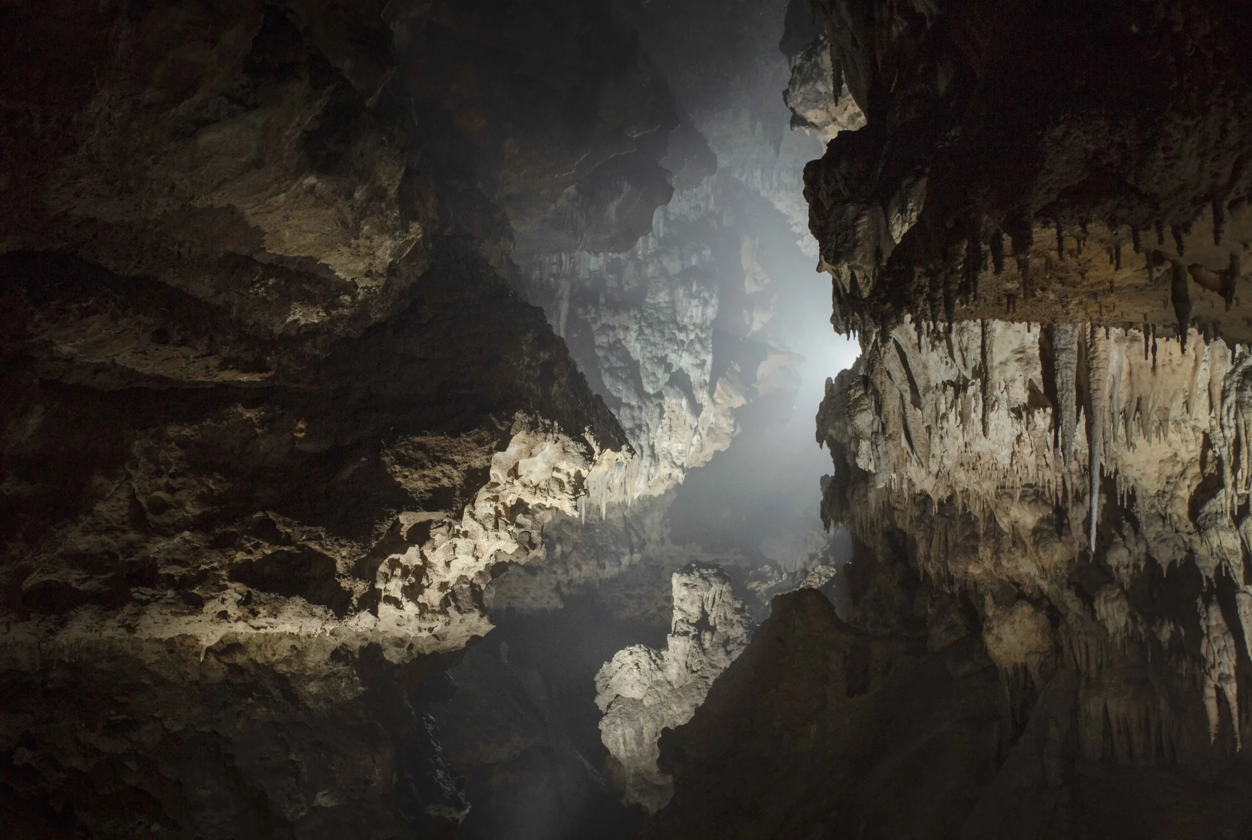
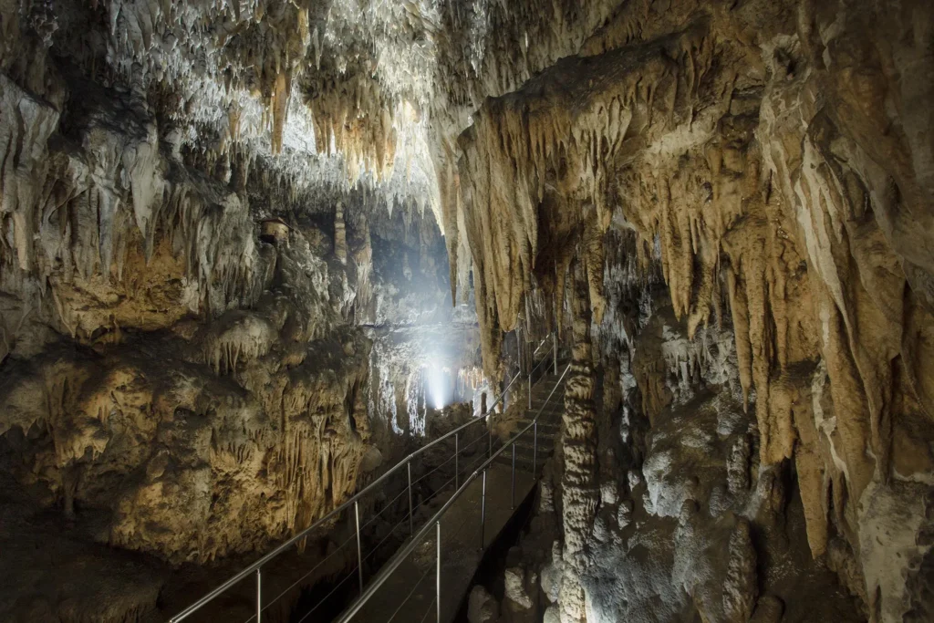
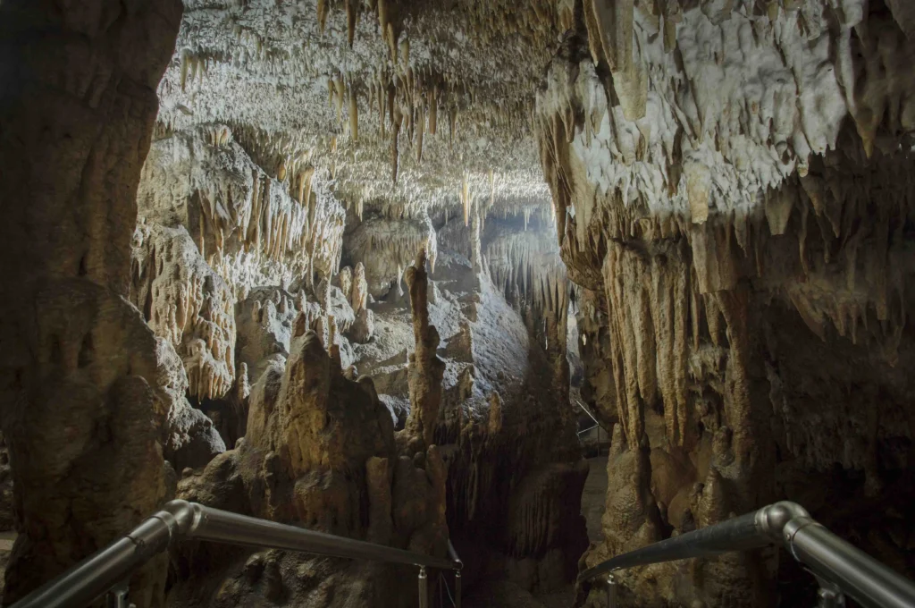
Navenakhevi cave – karst cave in Imereti, 235 m above sea level, in the village Navenakhevi of Terjola municipality. The Natenghevi Cave is a two-floor, 4-hall cave with unique and beautifully shaped stalagmites, stalagenes and stalactites. The cave divides into two from 30 meters from the entrance. The second-floor connects to the hall with small stages. The cave does not have an exit; it is stuck with a stalagnate, with a thickness of 7 meters.
The cave was first researched in the thirties by Professor Levan Maruashvili. In 1981, the local residents of the last century – sister Khujadzes first published about the cave in the press, from that developed an idea of equipping the cave. In 2007, Cave was granted a status of Nature Monument. It officially opened in 2018.
The visitors can see at the site: Visitor Center, Amphitheater, Cafeteria, Souvenir Shop, Educational Space, Children’s entertainment area and Forest Trails. You can organize the following eco-tours on the Nature Monument of Navenakhevi Cave: Speleo tour; Tours for photo-lovers; Conducting eco-lessons in the educational field;
View on map