Khashuri, Borjomi & Bakuriani



Khashuri Municipality is located in Shida Kartli, eastern Georgia, Its administrative center is a city of Khashuri.
In historical sources Khashuri is first mentioned in 1693. It became a city type settlement in the 60s of the XIX century, facilitated by the railroad in Georgia. The municipality is located at the crossroads of eastern, western and southern Georgia and therefore has a strategic location. located in the central part of Georgia – Khashuri is bordered by Kareli municipality to the north and east, Sachkhere to the north, Borjomi to the south and west and Kharagauli to the west. Municipality resorts are popular because of the climate, the healing mineral waters and the beauty of nature.
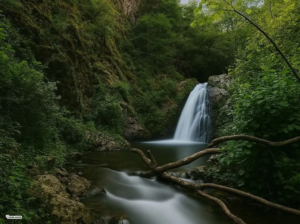
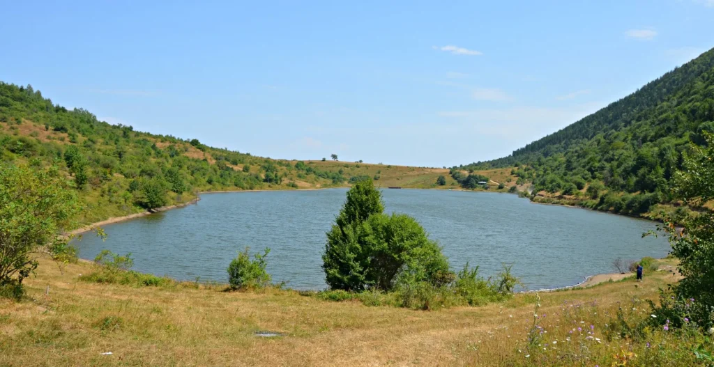
Khashuri municipality is distinguished by its beauty and abundance of cultural monuments. Mountains and mixed forests are beautiful both in spring and autumn. Excellent views from the Ghorinamkli mountain overlooking Khashuri and blue gleaming Lake Koditskaro. The beautiful Bijnisi Waterfall is a real paradise, especially if you decide to travel in the heat of summer.
Khashuri Municipality
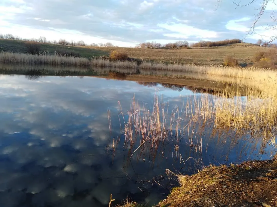
Keleti Lake is located in the village of Keleti, Khashuri Municipality, in the Shida Kartli region, at an altitude of 900 meters above sea level. The lake is located in a very beautiful place, on the edge of the forest. Fields, forest and a small lake create a wonderful environment for relaxing in nature. Despite its small area, Keleti Lake is quite deep. The water banks are surrounded by meadows. You can also fish on the lake. This place is convenient for short trips
View on mapTsromi Cathedral
Tsromi Cathedral is located in the village of Tsromi, Khashuri Municipality, Shida Kartli. It is an early medieval church, dating back to 626-634. The current church was built on the site of an earlier, 4th-century church. According to written sources, in 457, Razhden, who converted to Christianity during the reign of Vakhtang Gorgasali, was martyred in the early church of Tsromi. The current monument was built by order of Stephanos II. The church has been damaged and rebuilt several times over the centuries (in the 11th – 12th, 16th-17th centuries, and in the 20th century). On September 24, 1731, during the Lek invasion, the ramparts collapsed. During the earthquake of May 8, 1940, the dome of the cathedral, the walls of the square under the dome, a large part of the cylindrical arches of the narthex and the west-southern arms collapsed, and the western wall tilted. Restoration work carried out in the second half of the 20th century returned the cathedral to its original appearance. Tsromi Cathedral is one of the most important and visible monuments of the early Middle Ages.
View on map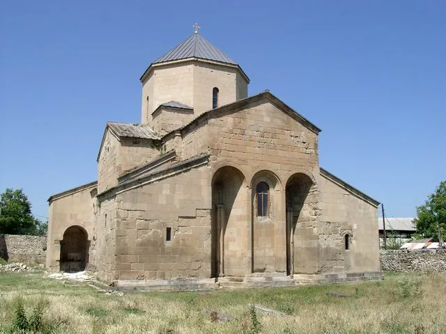

Surami, Castle & Fortress
Surami
On the foothill of the Southern slopes of Likhi range, 7 km away to the South-West from the municipality of Khashuri, 750 m from the sea level, there is situated the healing and spa resort of Surami. The climate is moderately continental, winter cold, nearby no snow, mean temperature in January -9 degrees. As for summer, it’s warm, mean temperature in August 20,2 degrees centigrade. Surami is surrounded by forests, which is the reason for its great, fresh air.
Most of all, it is popular among families with children. Its natural treatment factors are dry, subtropical air and deciduous forest spreading around the resort on 120 ha, mixed with embedded coniferous forest tract. There are also many mineral water springs in the settlement. As a resort Surami has gained its name since the end of the XIX century. During Turkish-Russian wars several military hospitals were operated here. It was discovered then, that Surami climate had a positive impact on patients, especially those, who had malaria.and like that, step by step, Surami became a popular haunt. Here you can have passive climate therapy and mineral water baths.
Surami Castle is a medieval fortress in eastern Georgia, in Shida Kartli, in the northern part of the town of Surami, Khashuri Municipality, on the left bank of the Suramuli River, on a rocky hill.
The fortress is important as a historical, monumental work of art. Surami Castle is located at the junction of two main roads; one leads through the Likhi Passages to the west, and the other through the Borjomi Gorge to the south.
The Surami fortress is a complex, including a walled fortress, St. George’s Church, a tower and a palace. The fortress had a tunnel that descends 12-16 meters, then is blocked below. According to legend, the fortress was connected to the Church of the Ascension and the Suramuli River, from which drinking water was brought to the fortress.
The exact date, when and who built the Surami Fortress “on the high cliff” is not historically known. In Georgian historical sources, Surami Fortress has been mentioned as a strategic point since 1625, when it was fortified by Giorgi Saakadze to protect itself from the Iranians.
There has been a legend about the Surami Fortress since ancient times people still sing about today : as if the reason for its invincibility is that, the only son of a mother is buried alive within its walls. “If the Surami Fortress was to be built, they had to put their only son, Zurab, inside the wall.” They say that on the side where Zurab was built in, even today, the tears of the mother Ankara flow drop by drop.

Itria Monastery
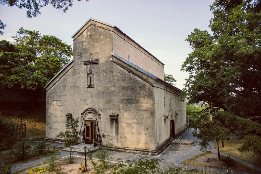
Itria Monastery – Itria St. Virgin Mary Convent – is located in the Shida Kartli region, in the Khashuri municipality, in the former village of Itria. The complex consists of a church, a bell tower and a wall and dates back to the 16th-17th centuries. The Cathedral of the Virgin Mary of Itria was built by order of Catholicos Dorotheos. During the construction process, a monument was burned, although the Catholicos still completed the construction of the monastery and donated many church items. In 1645, the King of Kartli, Rostom and his wife, Mariam, gave serfs and lands to the Itria Monastery. The monastery was destroyed many times. The complex was repaired in the 19th century.
Tabaklde, a.k.a Bijnisi Waterfall
Tabaklde (a.k.a) Bijnisi Waterfall is located in the village of Bijnisi, Khashuri Municipality, in the Shida Kartli region, at an altitude of 800 meters above sea level, on the eastern slope of the Likhi Range. This small, yet beautiful waterfall, hidden among the trees, creates a wonderful environment and is a great place for nature lovers. Bijnisi Waterfall is a beautiful sight, both in the spring greenery and surrounded by the colors of autumn. A small pond forms at the foot of the waterfall, where you can cool off in the summer heat. This place is perfect for light hikes and spending pleasant time with friends in the tranquility of nature.
Koditskaro Lake is located in the Shida Kartli region, near the village of Koditskaro, Khashuri Municipality, at an altitude of 975 meters above sea level. The depth of the lake is about 7-8 meters and is fed by groundwater. Surrounded by forested mountains and beautiful fields, the blue lake is a beautiful sight and a great place for nature and hiking lovers. In autumn, you will find the beauty of fiery colors here, and in spring, greenery and freshness. In spring, lovers of daisies will especially admire Koditskaro Lake, as there are beautiful daisies fields around the lake.
The resort of Kvishkheti is located in the Khashuri municipality of the Shida Kartli region, on the eastern slope of the Likhi ridge, 750 meters above sea level. Although Kvishkheti is part of the Khashuri municipality, it is considered a resort of the Borjomi group. This place is characterized by unique healing properties of the climate, which is determined by the combination of warm humid air masses coming from the Black Sea and mountain climate. Mineral waters with healing properties flow through the territory of the resort. Kvishkheti is especially useful for children suffering from respiratory diseases. Coniferous and mixed forests, mountains and beautiful views create an excellent environment for recreation. Kvishkheti has a low mountain subtropical climate, with moderately cold, little-snowy winters and warm summers. The average temperature in January is -1.90C, and in August – 20.70C. In addition to its healing properties and beautiful nature, the resort is also interesting from a cultural point of view. You can visit several cultural monuments here, such as: the Church of the Resurrection, the Kvishkheti Tower, the Mtatsminda Church, the Church of the Transfiguration, the Church of St. George and the Church of St. Elias.
Bulbuli Fortress is located in the Khashuri municipality of the Shida Kartli region, 1.5 kilometers southwest of the village of Bulbulistsikhe, on the road from Kvishkheti to Imereti. It is a feudal-era building built of cobblestone. The fortress is very damaged, only the remains of a semicircular tower in the western part and the southern wall with gunwales have survived. The height of the southern wall is 5 meters, and the length is 35 meters. The thickness of the wall is 1.2 meters in the upper part, and 2 meters in the lower part. Bulbuli Fortress was an important fortification in the Middle Ages on the road connecting eastern and western Georgia.
Akhaldaba is located in Samtskhe-Javakheti Region, 13 kilometers from the town of Borjomi, and is spread on both banks of the Mtkvari River. It takes an hour and a half to get to Akhaldaba from Tbilisi, and a similar amount of time from Kutaisi. A number of historic monuments are still preserved in Akhaldaba, including the remains of the 10th-century bridge and tower. However, the most remarkable monument is – “Tamari’s Fortress.” This fortress is located in central Akhaldaba, on the top of a hill surrounded by forest. The fortress dates back to approximately the 9th-10th centuries. Only the northeast side of the fortress has survived until today, and it is up to 10 meters high. According to archeological discoveries, it is most likely that the fortress was a large, logistic structure, with pits and reservoirs, and was designed to defend Nadzvi and Mtkvari Gorges, also central parts of Kartli region. The fortress would in fact block the entrance to Mtkvari Gorge. You can find pine trees and sulfur treatment waters in Akhaldaba, as well as broadleaf forests. Along with coniferous and broadleaf forests, Akhaldaba is rich in mineral waters
Borjomi Municipality
Borjomi is a municipality in southern Georgia, in the region of Samtskhe-Javakheti with a population of 24,998. Its main town and administrative center is Borjomi and it has an area of 1,189 km2. Borjomi municipality is located on the territory of the historical Tori.
The municipality consists in large part of subranges of the Lesser Caucasus mountains, the western end of the Trialeti Range and the eastern end of the Meskheti Range which are separated by the Borjomi Gorge through which the Mtkvari river flows.
Borjomi is a region of ancient culture and beautiful nature. There are many interesting monuments from different eras. Its nature, forests full of fresh air and healing mineral waters, alpine fields and lakes hidden in the green attract many travelers. The ski and balneological resorts of Borjomi Municipality are very popular. along with a pleasant stay and enjoying the beautiful nature, you can visit Megalithic buildings, medieval temples and fortresses here.
Nedzvi Managed Reserve is situated in Borjomi Municipality. Founded in 2007. The area is 8992 hectares. The territory of the Nedzvi National Park is an important site of the IX century architecture of Samtskhe-Javakheti, which is connected with the activities of Grigol Khandzteli and his students. The main purpose of the creation of the Nedzvi Managed Reserve is to protect and keep the local lynx and the unique groves of the Caucasian Fir.
A good place to eat is a restaurant Poria. They are famous for their Khachapuri but in fact, all dishes are really good. Here is their Facebook Page.
Poria LocationTown Borjomi
Borjomi is a resort town in south-central Georgia. 165 km from Tbilisi, situated in the picturesque Borjomi Gorge on the eastern edge of Borjomi-Kharagauli National Park.
The town is noted for its mineral water industry, the Romanov summer palace in Likani and the Borjomi-Kharagauli National Park. Borjomi mineral water is particularly well-known in Georgia as well as other countries that were part of the former Soviet Union; the bottling of mineral water is a major source of income for the area. Because of the supposed curative powers of the area’s mineral springs, it is a frequent destination for people with health problems. Borjomi is also home to the most extensive ecologically-themed amusement park in the Caucasus.
In the Middle Ages, the area of what is now Borjomi was part of the Tori province. It was populated by a series of forts guarding the strategic crossroad of routes leading to the western, eastern, and southern provinces of Georgia. Three important forts – those of “Gogia”, “Petra”, and “Sali” – still overlook the town from nearby hills. From the 16th century into the 19th, the area belonged to the noble family of Avalishvili, but was largely depopulated as a result of Ottoman inroads.
After the Russian annexation of Georgia, the Borjomi area began to revitalize. The toponym Borjomi was first recorded in the 1810s. The town and its surroundings were placed under the Russian military authorities. Borjomi began receiving soldiers in the 1820s. Buildings and baths began going up in the 1830s. Later The viceroy Mikhail Vorontsov, fascinated by local landscape and mineral waters, made Borjomi his summer residence and refurnished it with new parks. Its warm climate, mineral water springs, and forests made Borjomi a favorite summer resort for the aristocracy, and gave it its popular name of “the pearl of Caucasus”
new hotels were built, and an administration for mineral waters was established. In 1871, Borjomi was bestowed upon the royal family member, Grand Duke Mikhail Nikolayvich, then the viceroy of the Caucasus. In the 1890s, Mikhail’s son, Nikolay, built a park and a chateau at Likani, at the western end of Borjomi. The bottled mineral waters began to be extensively exported.
Following the Red Army invasion of Georgia in 1921, the Soviet regime confiscated all aristocratic mansions and turned them into sanatoria, frequented by the Communist party elite.
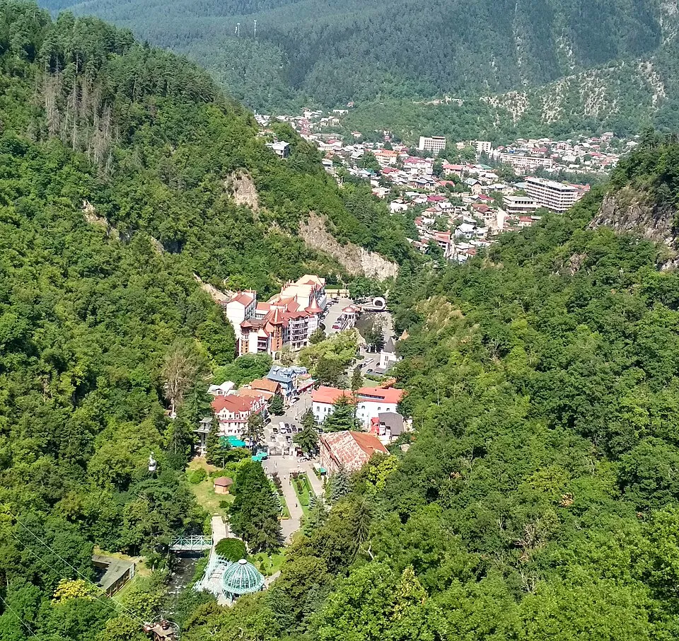

Borjomi Central Park, a lush paradise in Georgia’s spa town, where nature, mineral springs, and family-friendly experiences abound. Dating back to 1850, the park occupies a narrow wooded valley and is home to the town’s original mineral water source, Ekaterina Spring.
you can sample the therapeutic waters of Ekaterina Spring, renowned for their healing properties and unique taste, and bring a bottle to take home a refreshing sip of Georgia’s iconic beverage!
Borjomi Central Park is a haven for family-friendly activities, from charming playgrounds to the panoramic Ferris wheel. Thrill-seekers can embark on adrenaline-fueled adventures in the park’s adventure zone, complete with zip lines and rope courses, while those seeking relaxation can unwind in the serene atmosphere of outdoor cafes. Nature enthusiasts will adore exploring the park’s verdant forest trails or venturing up to the nearby Borjomi Plateau for awe-inspiring vistas of the surrounding mountains. The park also houses the enchanting Borjomi Museum of Local History, offering a glimpse into the town’s fascinating past and the development of its famed mineral waters.


Borjomi Cable Car – running since 1962, the cable car connects the popular tourist attraction of Borjomi Park with one of the highest points in the mountains surrounding it. The cable car provides you with a stunning view of the whole city, the park, Borjomi Valley, the Borjomula River, and the distant meadows
The Borjomi Cable Car can transport up to 25 people at one time, covering a distance of 376 meters.
nearby, a Ferris wheel surrounded by pine forest is the most noticeable landmark atop the plateau, affording a pretty spectacular view of the city below. You’ll also find a small church from the Middle Ages, and a quaint cafe serving authentic Georgian cuisine, beer, wine, and other refreshments.
Borjomi Sulfur Pools
While wandering the verdant depths of Borjomi Park, you’ll have the opportunity to extend your exploration by taking an easy walking path found at the rear of the park. Following the meandering path of the Borjomula River for two kilometres, you’ll soon come to a series of outdoor sulfur pools. Locals and tourists alike regularly visit this popular landmark, where you can relax under the open sky. Perfect for relaxing and having fun with friends and family, the Borjomi Sulfur Pools of various shapes and sizes give visitors an opportunity to unwind and experience the benefits of healing waters. With larger pools suitable for adults and smaller ones for children, it’s a perfect family activity. The warmest water can be found in the semi-circular pool. The area is well-equipped with modern conveniences such as showers and changing rooms. On average, the temperature of the water is between 32 and 38 degrees Celsius. The water that fills the pools has beneficial properties and has been found to help with issues of both the circulatory and endocrinological systems. The water is also recommended for people who suffer from issues of the spine or nervous system.


Borjomi-Kharagauli National Park
Borjomi-Kharagauli National Park – is located in the central part of Georgia and includes Imereti, Javakheti and Shida Kartli regions. Its total area is 107,083 hectares, which is more than 1% of the country’s territory. The National Park Administrative and Visitor Centers are located in Borjomi and Kharagauli.
The network of tourist routes in Borjomi-Kharagauli National Park allows one and multi-day hikes and includes a total of 12 marked and well-maintained trails. Tourist shelters, picnic and camping places are arranged along the paths, and there are places for lighting fires.
Visitors to the national park area can enjoy hiking, horseback riding, cycling, snowshoeing, cultural and educational tours.
View on map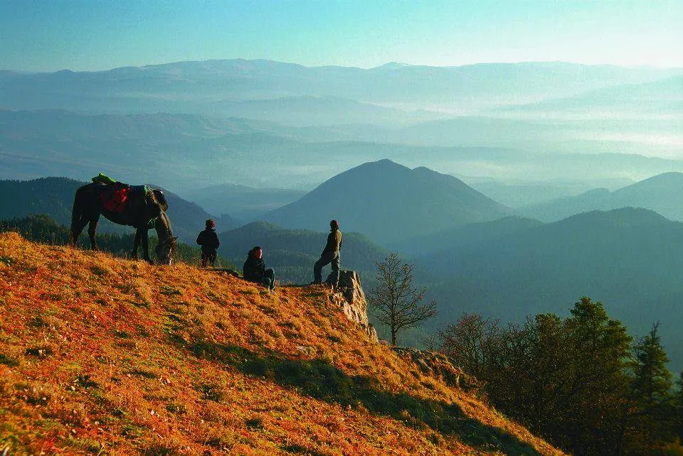

Likani Resort
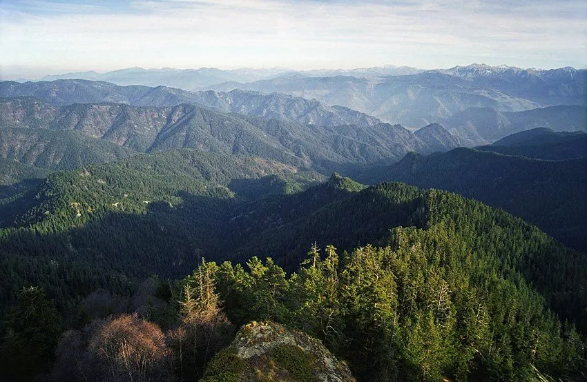
Likani is a townlet in Georgia’s Samtskhe-Javakheti region, located at the west end of the town of Borjomi in the Borjomi Municipality. Likani is adjacent to the Borjomi-Kharagauli National Park and is a popular mountain spa.
Winters are mild and not very snowy with an average temperature of -2.0 °C while summers are warm with an average temperature of 20-25 °C. The Likani Park, popularly exploited as a recreational zone, is dominated by oaks and conifer groves and hosts mineral springs similar in composition to “Borjomi”.
Important landmarks include a three-nave basilica church (8th-9th centuries) and the Romanov Palace (1892-95). The latter – projected by Leon Benois and designed by Leopold Bilfeldt – was built on the bank of the Kura River as a summer mansion of Grand Duke Nicholas Mikhailovich of Russia. In the Soviet times, the Likani residence passed into the property of the state and was frequented by key Soviet officials, including Joseph Stalin. In a newly independent Georgia, the palace functions as a summer residence of the President of Georgia.
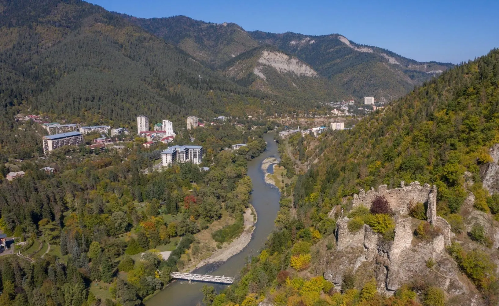
Petre fortress is located in eastern Georgia, in the Borjomi municipality, directly opposite the village of Likani, on the right bank of the Mtkvari River, on a high rocky mountain. It is a medieval monument.
The former name of Peter’s Castle is believed to be Kverbili Castle. The castle belonged to the feudal family of Avalishvilis. It guarded the bridge and road over the Mtkvari River from Likani to the historical villages of Papi and Nuasa (now Borjomi city districts).
After the Ottomans conquered Tori in the 16th century, Peter’s Castle became an Ottoman administrative center. The castle consisted of a citadel and a lower courtyard connected to it. The remains of various buildings have survived between the walls of Peter’s Castle and the inner citadel, and in the inner citadel there are ruins of living halls, kharoebi, and qvevri. The ramparts are lined with battlements and battlements. The fortress has been renovated many times. In some places, the walls of the earlier Taraz order are visible. The settlement of Kverbili, with a church and a cemetery, is contemporary with them (XI-XII centuries) at the foot of the fortress.
View on map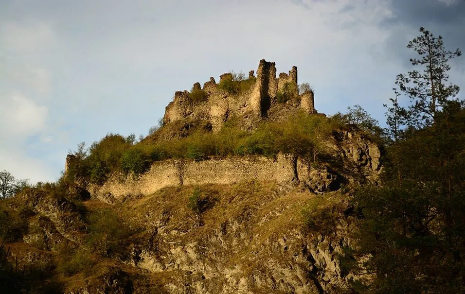

Green Monastery
Green Monastery (St. George Monastery of Chitakhevi) is located a few kilometers from Borjomi, near the village of Chitakhevi, in the middle of a dense deciduous forest. Today, there is still a monastery here, where monks pray for the well-being of the country and the people. According to scientists, this 9th-century monument was built by the disciples of the famous Georgian figure, St. Grigol Khandzteli – Christopher and Theodore. It consists of three basilica-type churches and a bell tower, where the carvings characteristic of Georgian architecture are still clearly visible. The church is contemporary with the foundation of the monastery and dates back to the middle of the 9th century. It is built of roughly hewn stone and has almost no decoration. The bell tower is two-story, the first floor is a chapel, and the second floor is a luxurious carved pediment.
During the invasions of Shah Tamazight in the 16th century, the monastery was sacked, the monks were tortured and killed. Even today, on the territory of the monastery, you can see numerous traces of the miraculously incorruptible blood shed by the monks during the time of trouble. This is the greatest holiness of the temple, which time cannot diminish.
View on map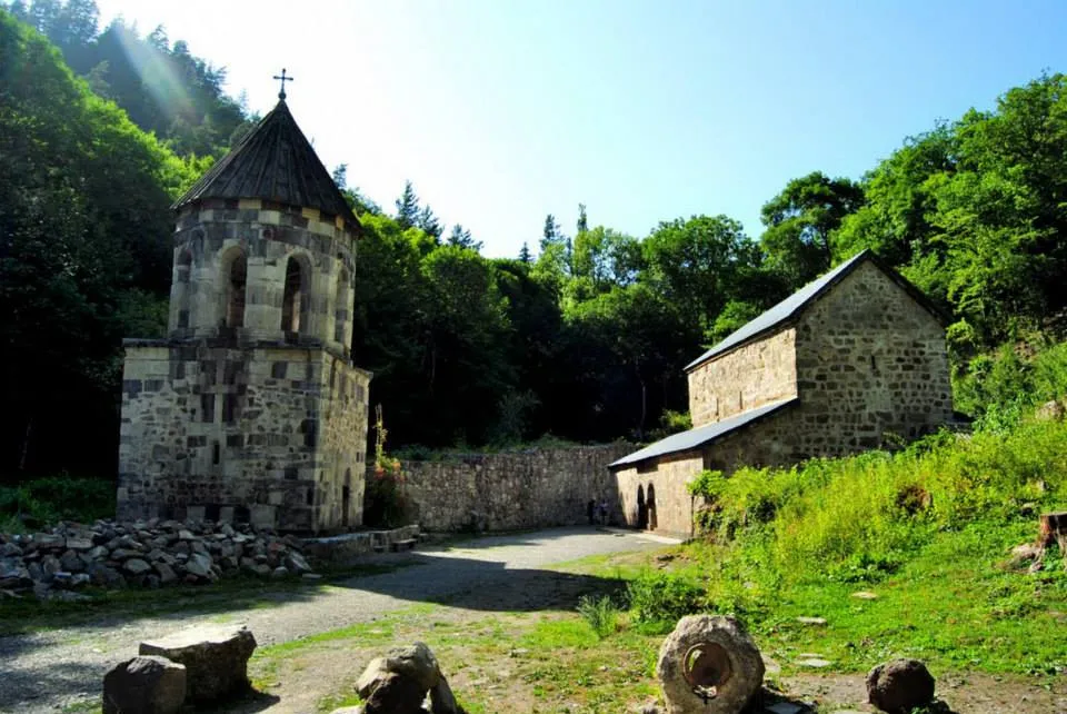
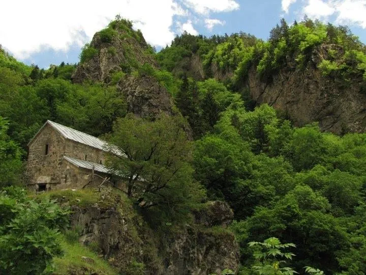
The Kvabiskhevi church of the Dormition also known as Mariamtsminda is a medieval Georgian Orthodox church, situated 2 km northwest of the village of Kvabiskhevi, Borjomi Municipality, in Georgia’s south-central region of Samtskhe-Javakheti. A three-nave basilica, the church was constructed in the 8th or 9th century on a high rocky mountain slope, overlooking the steep descent into the deep river canyon. The church is known for its 12th–13th-century fresco portrait of the young nobleman named Shota, who is popularly believed to be the contemporaneous epic poet Shota Rustaveli. The Kvabiskhevi church is inscribed on the list of the Immovable Cultural Monuments of National Significance of Georgia.
View on map

Kakhisi Lake is located on the western slope of the Trialeti Range, in the Borjomi Municipality. At 1752 m above sea level. Kakhisi Lake is one of the most popular and visited lakes in Georgia. The hiking season on the lake lasts from late spring to early autumn.
Kakhisi Lake is surrounded by a spruce forest, there are many picnic and camping sites here. Obtaining firewood is not a big problem, because there is a forest all around. There is also a summer village of Dabadzveli near the lake, and there is drinking water near the village. There are two more lakes near Kakhisi Lake, Chito and Tsero Lakes. Chito Lake is 1 km away from Kakhisi Lake, and Tsero Lake is 2 km away. Along the way, in the forest, in the summer, there are many berries, raspberries and blackberries. The trail is very easy and anyone can get here. The road from Dabadzveli to the nearest village, Chobiskhevi, is 8 km long, and only off-road vehicles can drive on it. If you are going up on foot, you can replace the serpentines with shorter paths and shorten the road.
View on map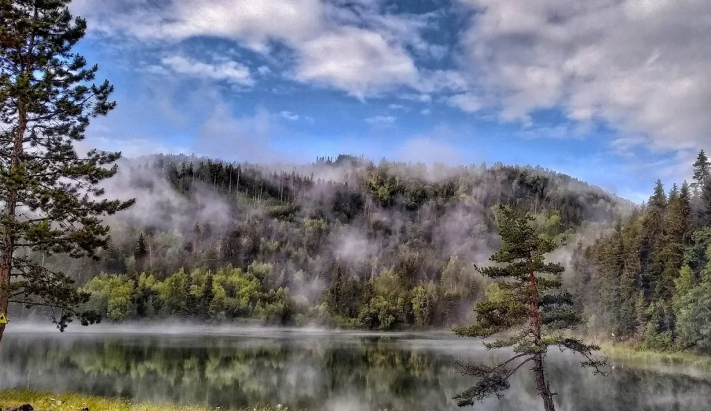
Daba St. George’s Church is located in Borjomi municipality in the village of Daba. The Church in Daba is one of the ancient and the strongest churches of Georgia. It is sheltered in the dense forest and is not visible from the road. The church is covered halfway by a cave. This temple is a characteristic monument of Georgian architecture of the XIV century. The carved inscription on the west wall says that the Daba church was built by the head of the royal treasury of George V the Brilliant. (1333)
The temple with numerous ornaments is especially noticeable. The church is a hall type. It has two entrances, from the north and the west. The first entrance is simple and the second with its pane is decorated with ornaments and an arch frame.
There is a legend, according to which doors were made for the church several times but with no good result, as they always fell down.
View on map


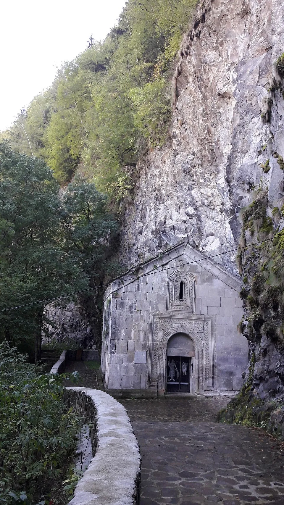
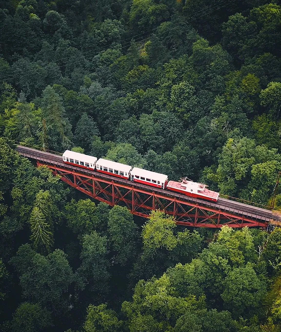
The Eiffel Bridge is a bridge over the Tsemistskal river, on the Borjomi–Bakuriani railway near the town of Tsagveri.
Grand Duke Michael Nikolaevich of Russia ordered the bridge from the French engineer-constructor and bridge builder Gustave Eiffel.
The construction of the bridge started in 1897 over the Tsemistskal River. The construction of the bridge was carried out by the constructor Besarion Keburia . From January 1902, the first “Kukushka” train (is not running since 2020) passed through the Borjomi-Bakuriani narrow-gauge railway line and over the bridge.
Tsaghveri town in Samtskhe-Javakheti Region is a unique place to hike and improve your health. Resting in this cozy place is equally beneficial for adults and children. Tsagveri is an urban-type settlement and a climatic-balneological resort, located 20 kilometers from the famous resort Borjomi, 1,025-1,050 meters above sea level, in the middle of mountains covered with coniferous forests. Tsaghveri is known for its healing waters and mountainous climate rich with solar radiation and sated with the coniferous forest scent. These characteristics are helpful for the upper respiratory tract, bronchia, and lungs. The climate strengthens the immune system and noticeably reduces the frequency of illness. Tsaghveri has snowy winters and dry summers. The best time to visit is between May and September.
Timotesubani Virgin Mary Monastery was built on the eve of the XII-XIII centuries in the village of Timotesubani, municipality of Borjomi. It was built by Shalva Eristavt-Eristavi Akhaltsikheli, the owner of the Tori.
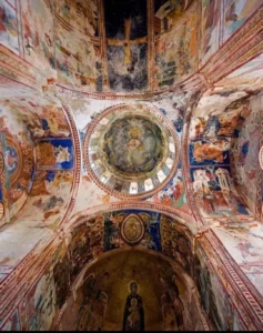
The central temple is in the name of Virgin Mary and is Georgia’s one of the most important monuments. The dome is decorated with azure bricks. The height of the temple (with a cross) is 28 meters, width -19 meters and length- 11 meters. The windows on the north wall are built up and painted. Temple painting dates back to the years 1205-1215 (epoch of Queen Tamar) and is unique. We can say that the painting of the temple is one of the most sophisticated for its era. Most of the frescoes survived to our days.
On the northern terrace, there is a small single-nave basilica of Saint Barbara while to the northeast of the temple are the remains of a tomb made of stone.
View on map
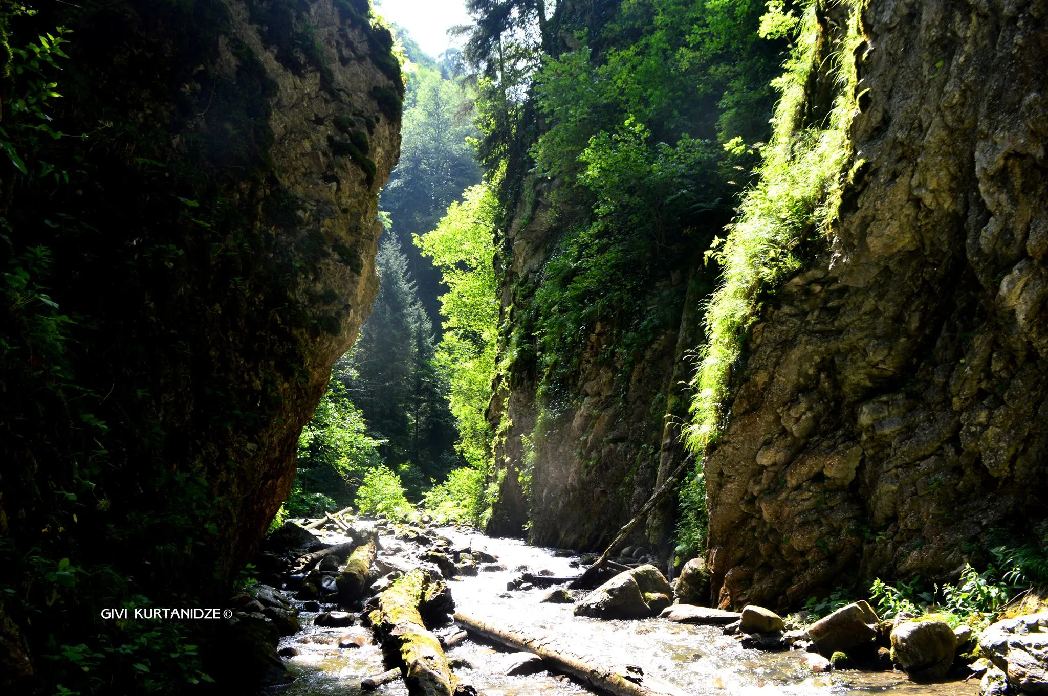
Meghruki Gorge
This trail starts at Sakhvlari tourist shelter and goes through the Meghruki River valley. The slopes of the canyon are covered by Colchic subtropical forest, the length of the trail is 5.5 km. The Meghruki valley micro-climate offers you the possibility to escape from hot summer days and shelter in the cool environment which awaits you during the trail.
You will have to visit Nikoloz Romanov or St. Andrew tourist trails where you can sightsee on the trail in case of overnight in Sakhvlari. The shortest way to get to Sakhvlari Tourist Shelter starts from Marelisi ranger station.
The visit to Borjomi-Kharagauli National park is not free. For registration, booking of the tourist shelter and other services contact/visit Borjomi-Kharagauli National Park Visitor Center.

Bakuriani
Bakuriani is a town in Borjomi Municipality. It is located on the northern slope of the Trialeti Range, on the banks of the Bakurianistskali River (a tributary of the Gujaretskali River), 1700 m above sea level, 30 km from Borjomi.
The Bakuriani area is covered with coniferous forests. The Bakuriani Botanical Garden is located in the surrounding areas of the town.
Bakuriani is a famous mountain-climatic resort and a mountain-skiing center of international importance. The first ski base was opened in 1932. Cable cars have been laid from Bakuriani to Mount Kokhtagori (1.3 km) and to the Tskhratskaro Pass (3.5 km), and ski jumps have been built. Artificial snowmaking operates on the Didveli ski slopes.
Mitarbi – Ski resort in Borjomi Municipality (Bakuriani community), situated on the northern slope of the Trialeti Range, 1640 meters above sea level. The resort Mitarbi was opened on December 25, 2016. It is located 7 kilometers away from Bakuriani, and 37 km away from Borjomi.
Three new ski lifts have already been installed by one of the leading manufacturers, “Doppelmayr”at Mitarbi resort.
Mitarbi I- Sixpack Chairlift Detachable
Mitarbi II- Quad Chairlift Fixed Grip
Mitarbi III- Cable car- T-Bar
Mitarbi Resort ski tracks are for all levels of skiers: intermediate, advanced and expert. The total length of the tracks is 10 km. Resort Mitarbi is connected to Kokhta Resort by cableway.
Kokhta – Ski resort in Borjomi Municipality ( Bakuriani community ), situated on the northern slope of the Trialeti Range, 1640 meters above sea level. The resort Kokhta was opened on December 27, 2015. It is located 5 kilometers away from Bakuriani, and 35 km away from Borjomi.
Two cable cars are functioning on the resort- a 6 person seating with a rolling binding system – with an intermediate station. Kokhta Resort ski tracks are for all levels of skiers: average and experienced ones. The total length of the tracks is 3.1 km. Resort Kokhta is connected to Mitarbi Resort by cableway.


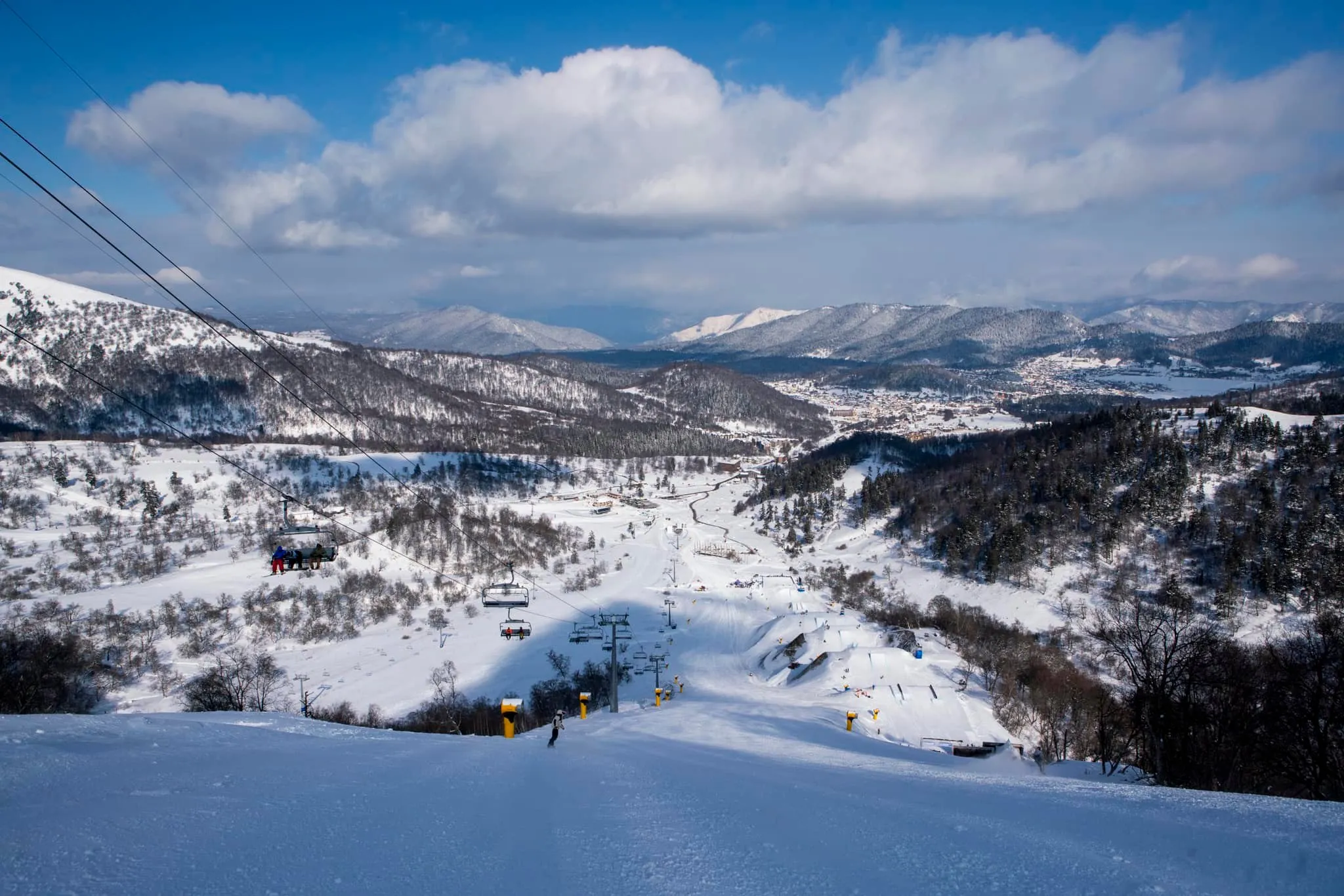
Tabatskuri Lake
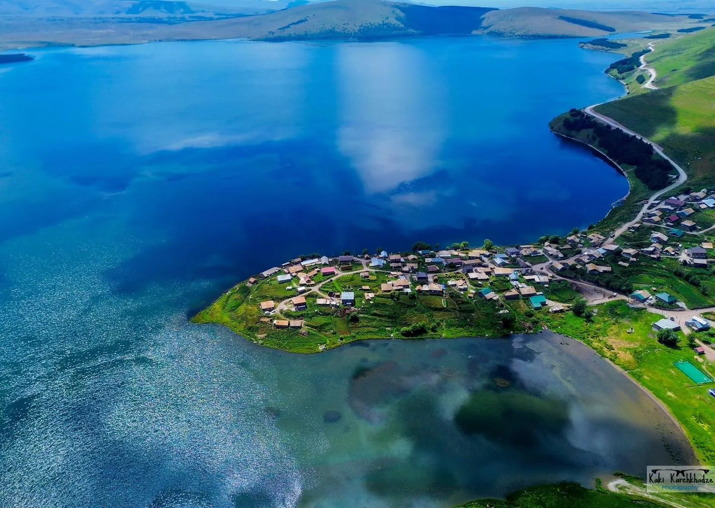
Tabatskuri Lake is a volcanic freshwater lake in southeastern Georgia, located between Borjomi and Akhalkalaki. It is known for its scenic beauty, diverse wildlife, and outdoor activities like hiking and fishing. The lake is situated at an altitude of nearly 2,000 meters, is up to 40 meters deep, and is surrounded by the Ktsia-Tabatskuri Managed Reserve
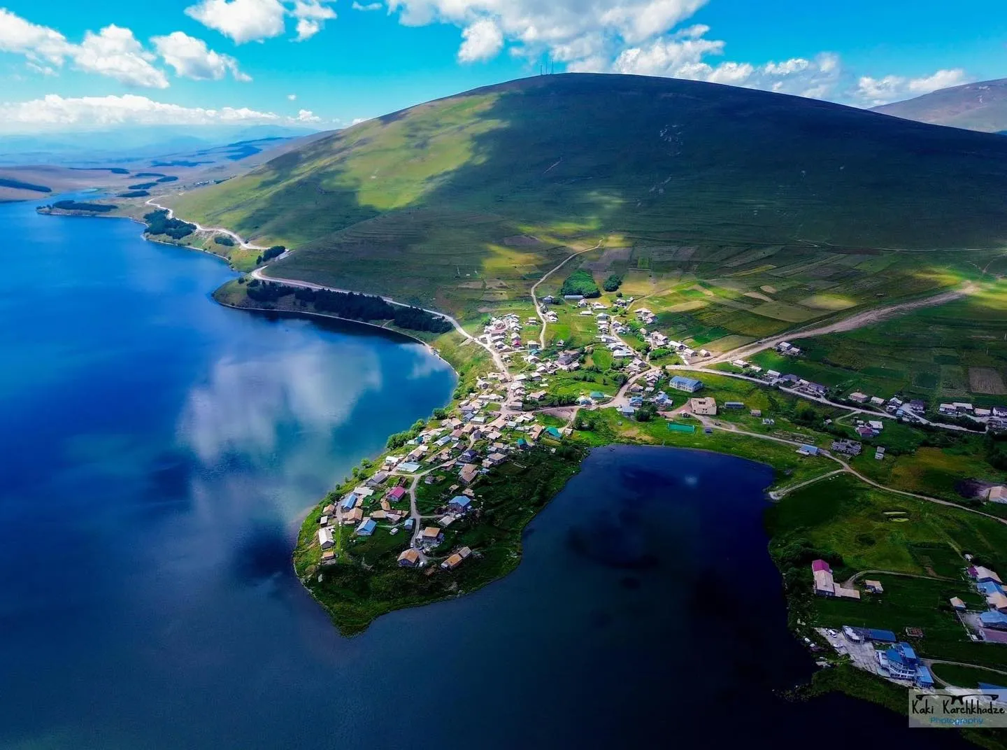
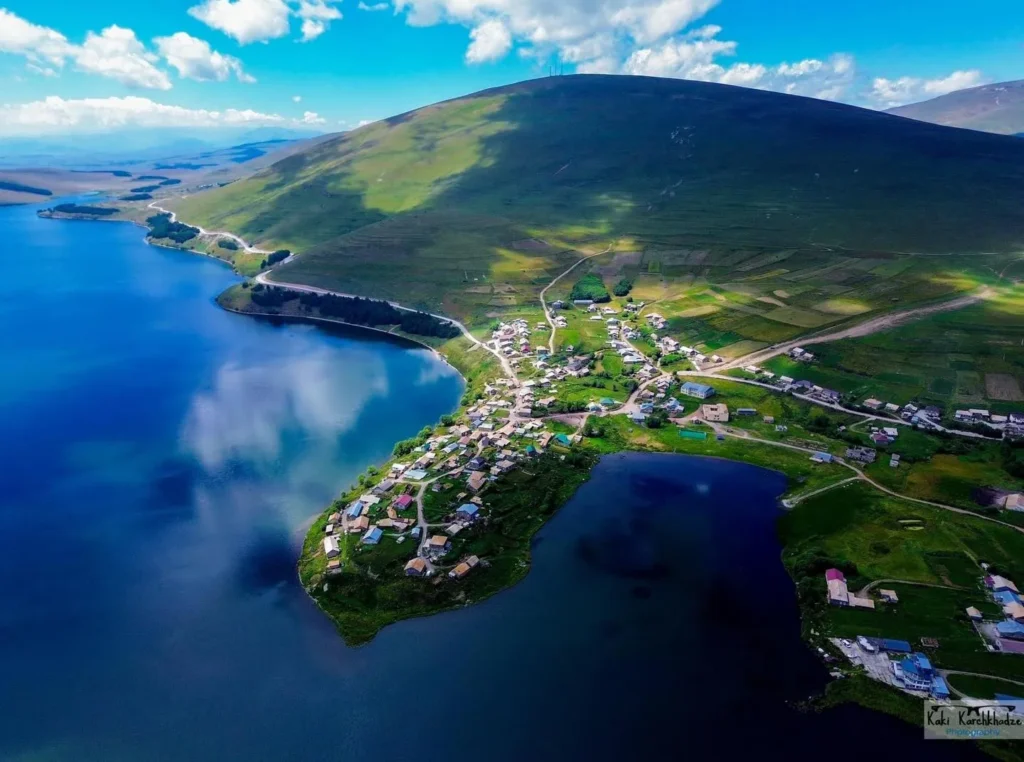
The village of Tabatskuri is located in the Aspindza Samtskhe-Javakheti region, in the Borjomi municipality, at an altitude of 2000 meters above sea level, on the shore of Lake Tabatskuri. Part of it is built on a peninsula. The local population is mainly engaged in dairy production, fishing and cattle breeding. The village of Tabatskuri, located on a peninsula protruding into the lake (2000 meters above sea level), the blue lake, open spaces and mountains create a beautiful sight. In addition to amazing views, in the village, you can see one of the most important examples of Georgian architecture, the 10th century Tabatskuri Red Church and the 19th century Armenian Church, the White Church of Tabatskuri. Tabatskuri is one of the great places in Samtskhe-Javakheti, with its diverse, impressive landscape and rich cultural monuments, to enjoy nature and relax. It is also often photographed by photographers due to its natural beauty and interesting location.
Tabatskuri is 60 km from Borjomi. It can be reached from two directions, from Akhalkalaki and Bakuriani. If you go beyond Bakuriani, a dirt road begins, which can be traveled by sedan, although caution is required. In winter and early spring, it is impossible to get to Tabatskuri from Bakuriani by car, the road is closed. The last section of the road from Akhalkalaki is also dirt and can be traveled by sedan. In winter, it is only possible to get to Tabatskuri from Akhalkalaki.
View on Map